
Great Bushwalks in NSW National Parks

New South Wales is home to some of Australia’s most spectacular landscapes, best explored through the many bushwalks in NSW National Parks. From the mist-shrouded sandstone cliffs of the Blue Mountains to the jagged volcanic spires of the Warrumbungles and the massive, ancient granite domes of Bald Rock, these protected areas offer truly unforgettable hiking experiences for every adventure
Table of contents
- Blue Mountains National Park
- Grand Canyon
- Historic Federal Pass
- Warrumbungle National Park
- Bald Rock National Park
Blue Mountains National Park Walks
Many of the best bushwalks New South Wales are found in the spectacular Blue Mountains National Park. This vast and rugged region is home to one of Australia’s most iconic national parks and is listed as a UNESCO World Heritage site. With its dramatic cliffs, deep valleys, waterfalls, and ancient forests, the Blue Mountains are a paradise for nature lovers, keen photographers, and hikers of all fitness levels.
We fell in love with the charming town of Blackheath, which became our home base for much of our time in the Blue Mountains. While our hiking boots may have seen their best days, we now enjoy exploring at a more relaxed pace, taking time to appreciate the scenery — and with frequent visits to the Blackheath Golf Course. From there, we discovered many of the region’s outstanding walking tracks. There were far too many to mention them all, but highlights included the Grand Canyon Track, walks down into the Grose Valley, and the spectacular cliff-top walks around Katoomba.
Govetts Leap Lookout & Grose Valley Walks
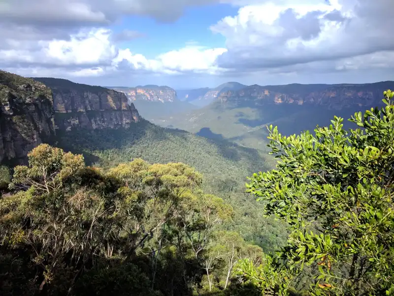
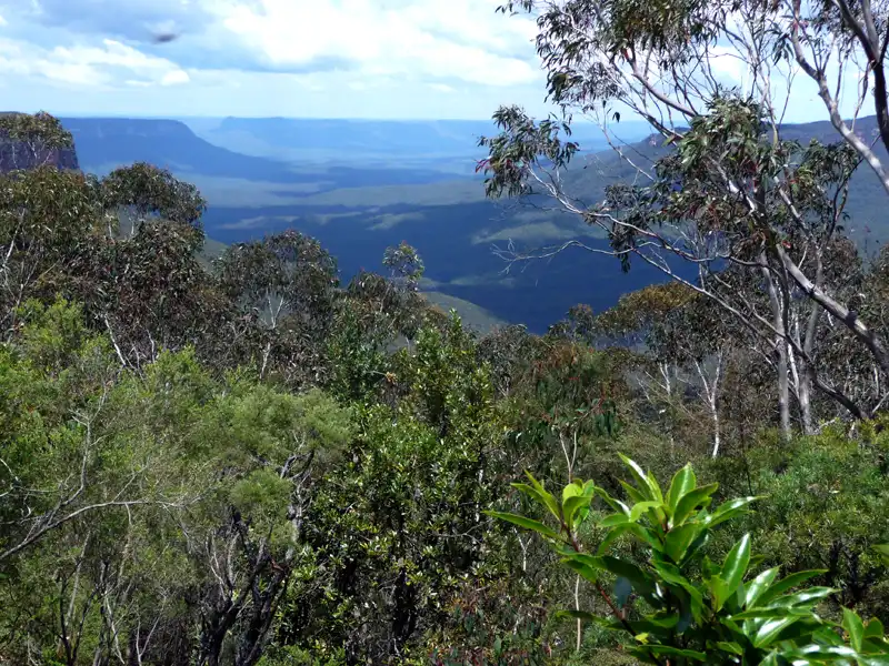
Not far from Blackheath is Govetts Leap, one of our favourite spots in the Blue Mountains. This spectacular lookout offers sweeping panoramic views across the Grose Valley and its dramatic sandstone cliffs.
We reached the Govetts Leap lookout in various ways—sometimes by a short drive, and at other times on foot. The options range from the easy Fairfax Heritage Track, which winds from the Blue Mountains Heritage Centre to the lookout, to the more challenging Popes Glen Track. We would often return the same way, or occasionally tackle the more demanding but highly rewarding cliff-top track and the long, scenic Braeside Trail.
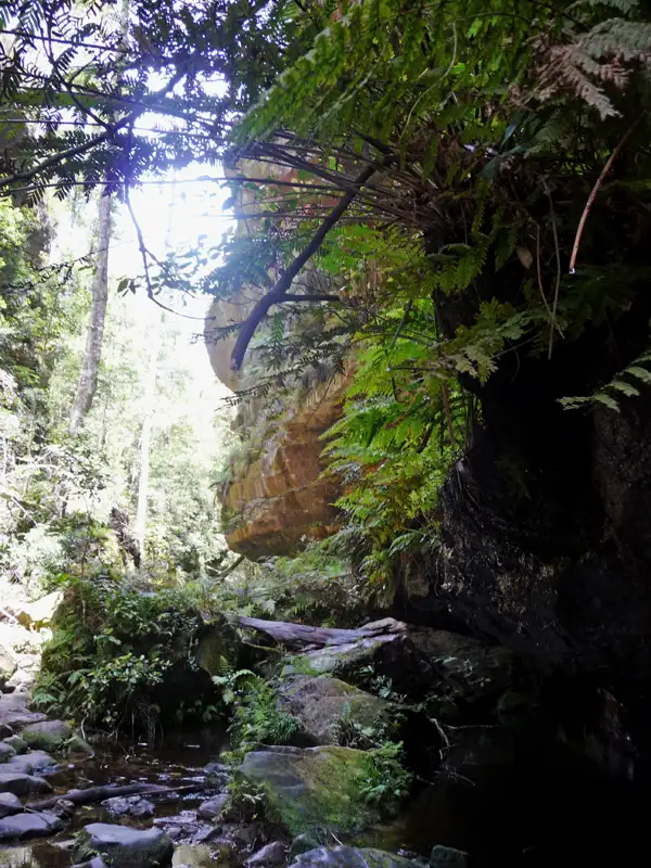
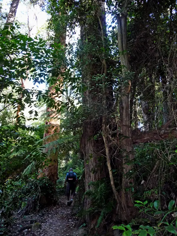
Over the years, we have tackled many bushwalks in the Blue Mountains, but the trek from Govetts Leap to Pierces Pass remains the most challenging. This 7–8 hour journey through remote wilderness is graded 4 for its steep climbs and rugged terrain. The first hurdle is the daunting descent from the sheer cliffs of Govetts Leap into the Grose Valley. Looking down, the path seemed impossible—but once we took that first step, the challenge became perfectly manageable.
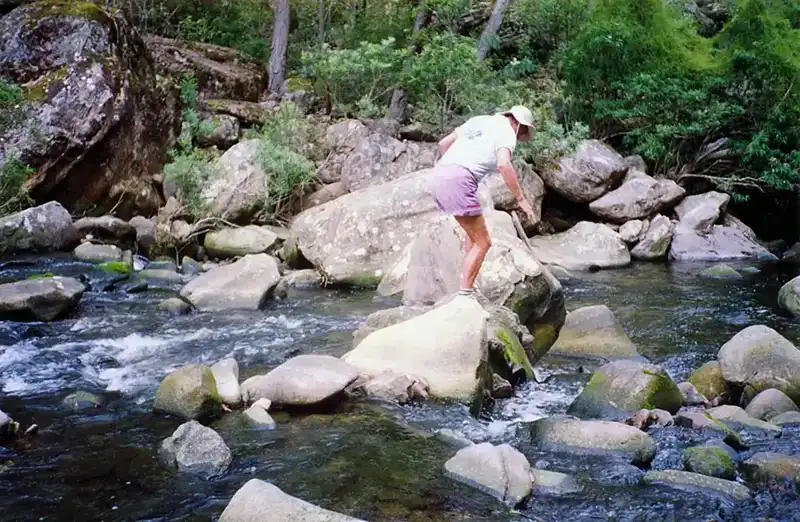
The descent down the 600-metre cliff was not physically demanding, but it required great care, as the trail included steep sections with stairways and narrow ledges. We paused many times to photograph the spectacular hanging swamps clinging to the cliff face. The real challenge began in the Grose Valley, where we had to cross the river multiple times as we made our way deeper into the wilderness.
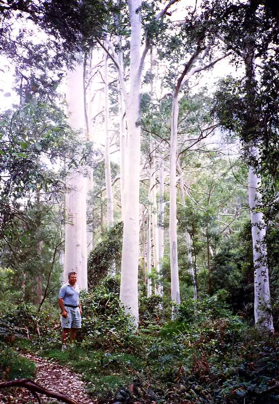
The majestic Blue Gum Forest marks the halfway point of the walk. Many hikers carry a tent and camp here overnight before continuing their bushwalk, but we travelled light with only food and water. We enjoyed a lovely lunch beneath the towering trees, accompanied by the constant chorus of cicadas. Afterward, we walked for another four hours, with the final stretch a long uphill climb. By the end, we were extremely thirsty, having completely run out of water — a clear reminder of just how demanding this hike can be.
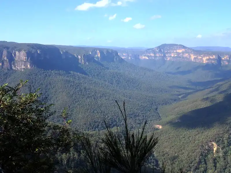
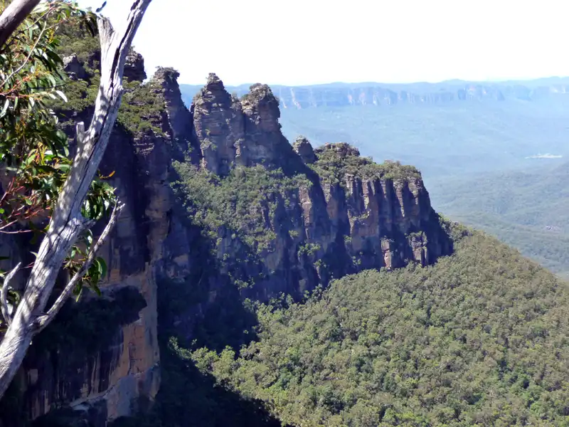
Evans Lookout is another outstanding viewpoint in the Blue Mountains, and we can never decide whether it or Govetts Leap Lookout offers the better panoramic views across the Grose Valley. The best solution is to visit both — take in the view at one lookout, then enjoy the beautiful cliff-top walk to the other. This scenic 3-kilometre track takes about 1.5 hours one way and is one of the finest short walks in Blue Mountains National Park.
Back to table of contents
Grand Canyon Track
The Grand Canyon Track is widely considered one of the most popular bushwalks in NSW National Parks, specifically within the iconic Blue Mountains. This fantastic and moderately challenging hike descends between towering sandstone walls carved over millions of years. While the grade 3 circuit typically takes three to four hours to complete, the stunning waterfalls, lush ferns, and sweeping valley views mean most walkers will happily spend much longer on the track.
We have completed the Grand Canyon loop both ways — starting from Evans Lookout (clockwise) and from Neates Glen (counter-clockwise). Based on our experience, and the advice of local walkers, we prefer starting from Neates Glen. While the initial descent to the canyon floor is steeper, the final climb out to Evans Lookout is much easier, making the walk more enjoyable overall.
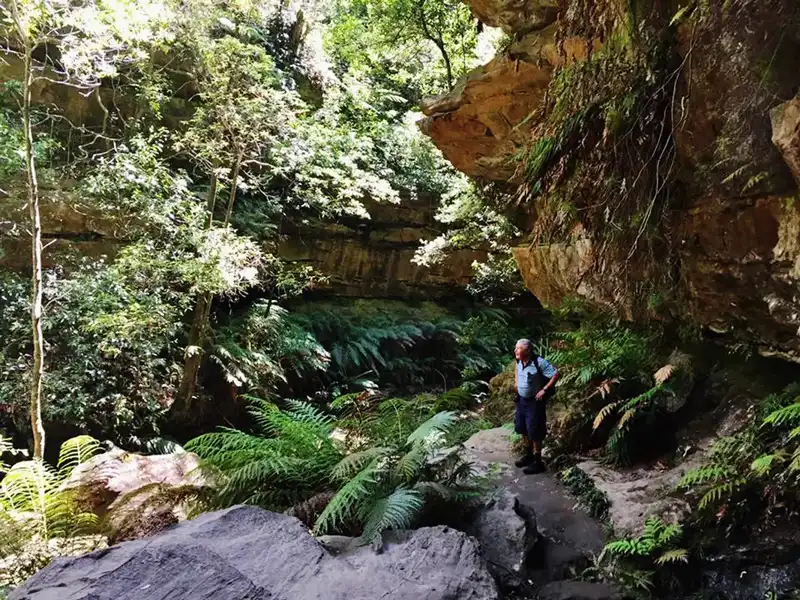
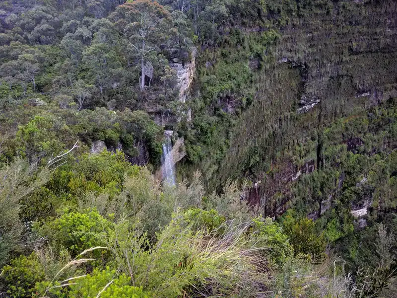
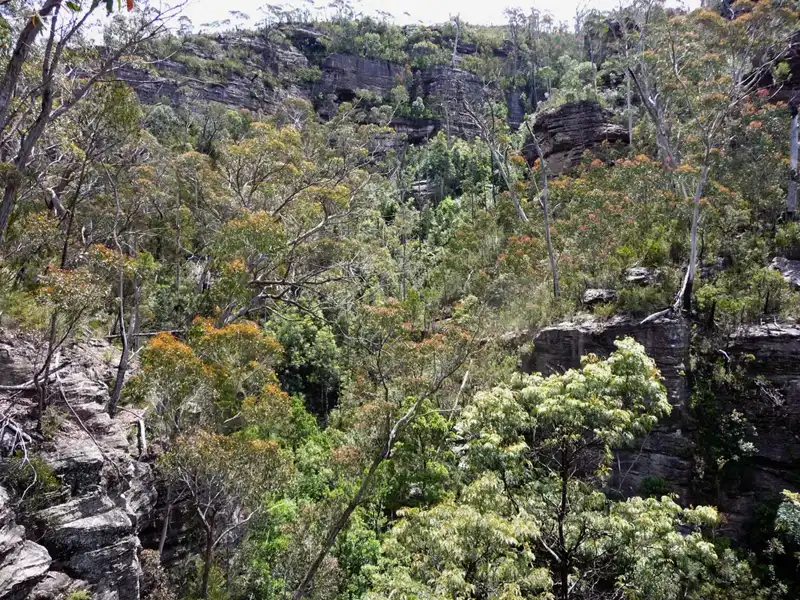
Along the Grand Canyon hike, you’ll find cascading waterfalls, lush fern-filled gullies, sandstone walls, and several impressive rock overhangs. The cool, shaded spots along the trail are perfect for a rest or picnic. On our descent to the canyon floor, we stopped many times to enjoy the magical atmosphere and shot photos of this beautiful landscape.
Inside the canyon, conditions remain damp and cool, even in the height of summer. It is vital to never enter a canyon before, during, or after heavy rain; always check the local weather forecast and National Park alerts before setting out. We found it necessary to watch every step carefully to maintain our footing, as the trail involves several water crossings and sections that are notoriously slippery.
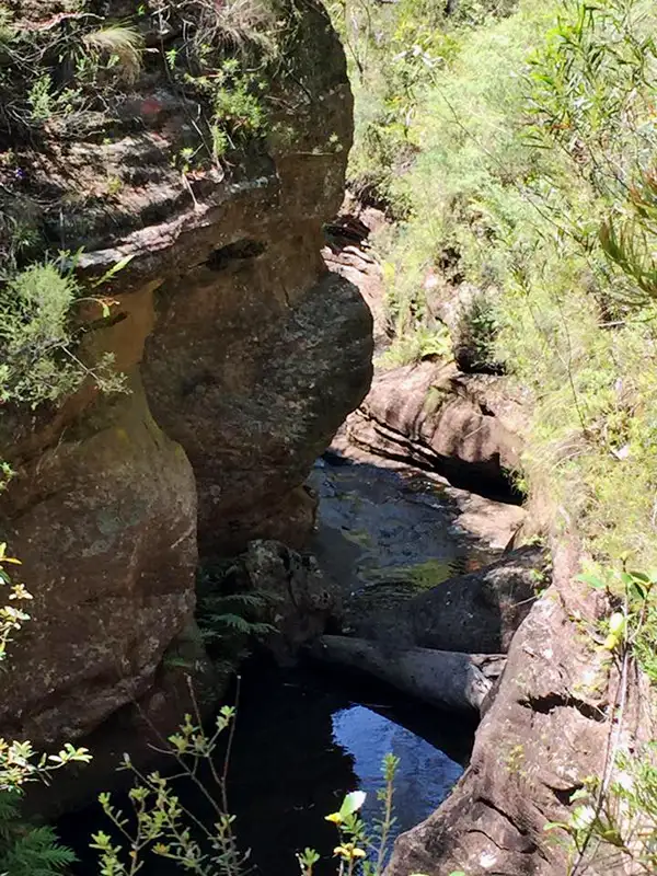
At the bottom of the Grand Canyon, the trail crosses Greaves Creek. If you are fortunate, you might spot one of the large, brightly coloured crayfish that inhabit these waters. From the creek, the path begins a demanding, steep ascent toward Evans Lookout. At this point, there is also a key junction where you can connect to longer bushwalks descending deeper into the Grose Valley.
Back to table of contents
Scenic World Rainforest Walk and the World’s Steepest Railway
Among our favourite hikes in the Blue Mountains is the walk from Katoomba’s Scenic World to the Leura rainforest. This unforgettable route has it all — Katoomba Falls, the scenic Prince Henry Cliff Walk, breathtaking views of the Three Sisters, lush rainforest scenery, and a thrilling ride on the world’s steepest railway.
Option 1
This hike begins at Scenic World. From here, follow the Prince Henry Cliff Walk to Echo Point, then descend the Giant Stairway with its 998 steps. Before starting the descent, make sure your knees are in good shape — it is a real knee-challenging workout! At the bottom, follow Federal Pass to the Scenic World Cableway station.
Option 2 (recommended route)
This is the route we love and highly recommend. Walk to Echo Point the same way as in Option 1, but then stay on the Prince Henry Cliff Walk until you reach the turn-off to Leura Forest. From there, descend along Linda Creek into the rainforest. While the cliff walk offers spectacular views, this section feels completely different — it is lush, quiet, and filled with a mystical atmosphere that makes the walk truly special.
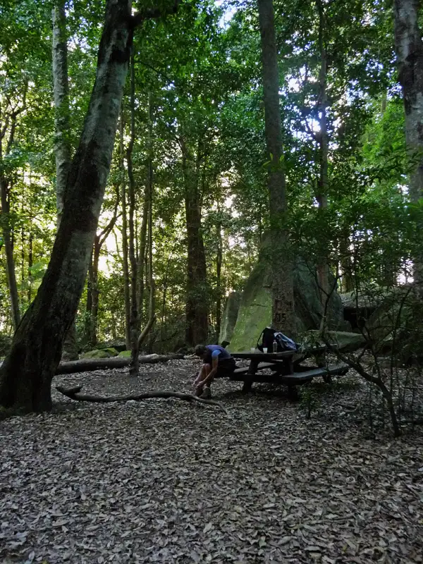
Leura Forest is about the midway point of the walk and a perfect picnic spot in the Jamison Valley, located at the junction of the Federal Pass and Dardanelles Tracks. Sitting in the rainforest beneath lilly pilly and coachwood trees, it is the ideal place for lunch and a moment to enjoy the serenity of the valley. This peaceful spot also has a fascinating history — in the late 1800s, a popular teahouse called the Lady Carrington Dining Hall once stood here.
After your break, continue on the final 2.5-hour stretch toward the bottom station of the Scenic Cableway. You have two bushwalking options to reach the station: the historic Dardanelles Track or the Federal Pass. It is essential to arrive before 4:00 PM to catch the final ride up. Missing this window means facing a grueling, steep ascent to the cliff top after an already demanding day on the trail.
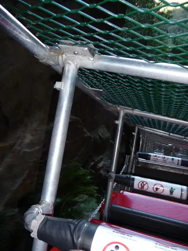
This remarkable cable car, the steepest of its kind in the Southern Hemisphere, offers a fun and efficient way to return to the cliff top. While the ride is thrilling, do not expect sweeping vistas; the journey is over quickly, with much of the ascent passing directly beneath dramatic, overhanging rock walls. Even so, it is a rewarding and effortless way to conclude a long hike.
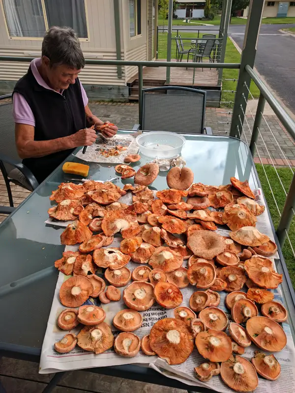
Our trip wasn’t just about bushwalking; we also made time for some mushroom foraging. In NSW, the go-to spots for pine mushrooms are the Southern Highlands and Oberon. Since we were already hiking in Blackheath, we took a detour to Oberon to try our luck before heading home. We hit the jackpot, harvesting enough Saffron Milk Caps and Slippery Jacks to last us a year! Interestingly, we’ve found these exact same mushrooms while hiking in another part of the world. Any guesses where?
Warrumbungle National Park Walks
Warrumbungle National Park is located in New South Wales and is renowned for its dramatic volcanic landscapes, rich wildlife, and outstanding stargazing. Home to some of the most iconic bushwalks in NSW National Parks, its most striking volcanic formations include the Breadknife, Belougery Spire, and Bluff Mountain. In 2016, the park was declared Australia’s first Dark Sky Park, recognised for its exceptional night skies and minimal light pollution.
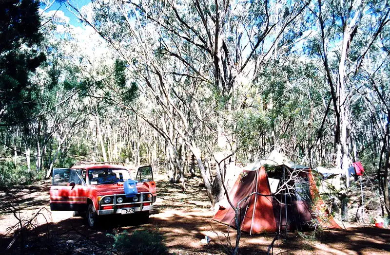
The first camping trip we took after arriving in Australia was to Warrumbungle National Park, near the town of Coonabarabran in NSW. We stayed at a remote campsite halfway up the mountains, and it was incredibly peaceful—there was just one other camper. The site had basic facilities, including a wood fire pit and toilets. For showers, we had to hike about 45 minutes down to another campsite.
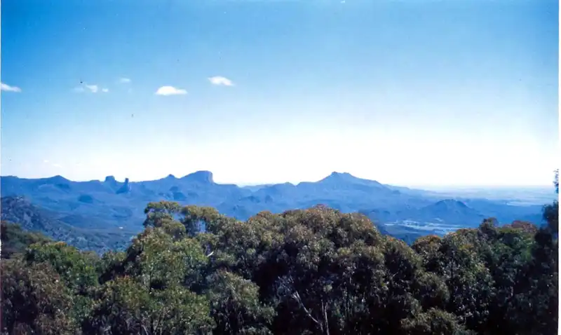
The bushwalks and scenery were truly stunning. Unfortunately, this was before we had a digital camera, so we took far fewer photos than we would today and have only a handful of images. Even so, the dramatic landscape remains just as impressive.
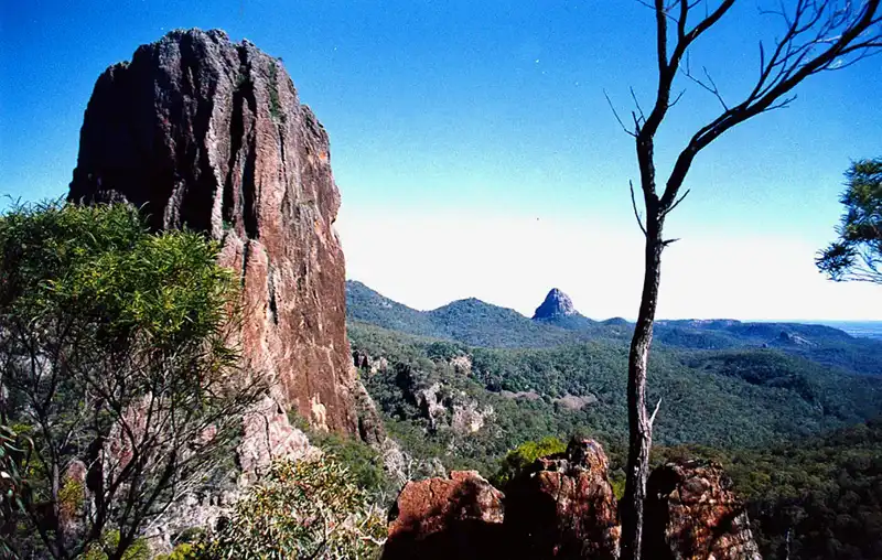
We tackled a couple of challenging bushwalks, including the Breadknife Track and the Grand High Tops Walk—a 13 km trek that took us about five hours to complete. The panoramic views were spectacular, and we were thrilled to spot two koalas along the way.
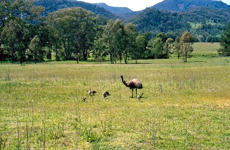
The Warrumbungles are a fantastic place to spot native wildlife, including kangaroos, emus, and even koalas. However, koalas aren’t always easy to find—spend too much time scanning the treetops and you might forget to watch your step!
Back to table of contents
Bushwalks in NSW National Parks – Bald Rock
Named after the colossal granite dome at its heart, Bald Rock National Park is home to Australia’s largest exposed monolith. This natural wonder measures nearly 750 metres long and 500 metres wide. Located near the border between NSW and Queensland, the park offers stunning bushwalks through its granite landscapes and eucalyptus forests, which we thoroughly enjoyed.
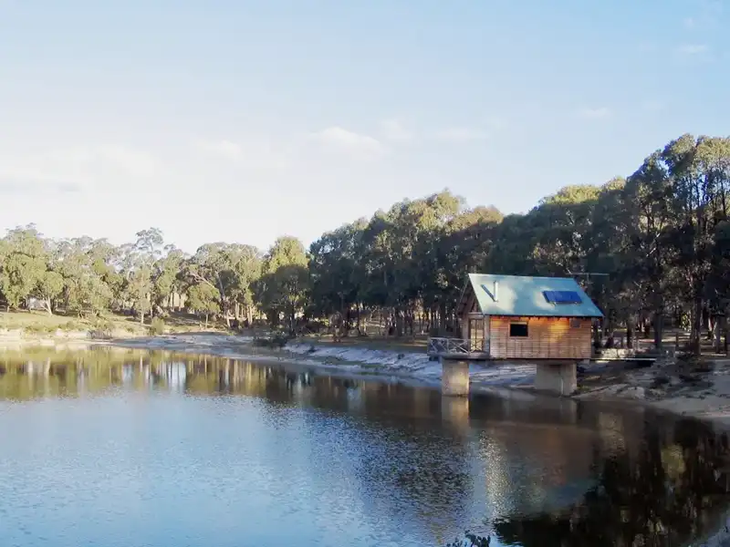
On our way back from hiking in Lamington National Park, we spent a couple of days at Bald Rock Bush Retreat. It’s set on a 255-hectare property near Bald Rock National Park, about 36 km from Tenterfield. The cabin was small but charming and very romantic, overlooking a dam in the heart of the bush. It was incredibly peaceful, with nothing but the sounds of the forest and wildlife all around us.
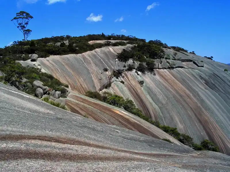
We headed up to the Bald Rock Summit; the first 340m of the track is a gentle stroll through beautiful old-growth forest where you might catch the song of the elusive lyrebird. From there, things get more adventurous as the path turns into a steep scramble up the rock face itself. It’s a challenge, but you’re rewarded with an unbelievable 360-degree view from the 1,277-metre summit. While the descent can be even trickier on the knees, there is a gentler, though longer, route back via the Bungoona Walk.
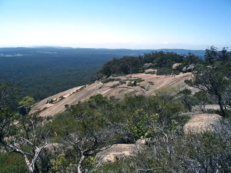
We weren’t quite ready to leave the summit, so we took a quick detour to the Trig Lookout. The views from there are breathtaking—you can see across the New England Highlands all the way to the soft blue silhouettes of the Border Ranges on the horizon.
Hiking the bushwalks in Bald Rock National Park feels like wandering through a granite wonderland. It’s one of the highlights of exploring bushwalks in NSW national parks, with Red Stringybarks, Banksias, Grevilleas, and beautiful Rock Orchids along the way.
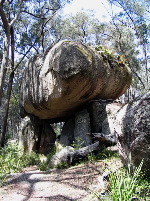
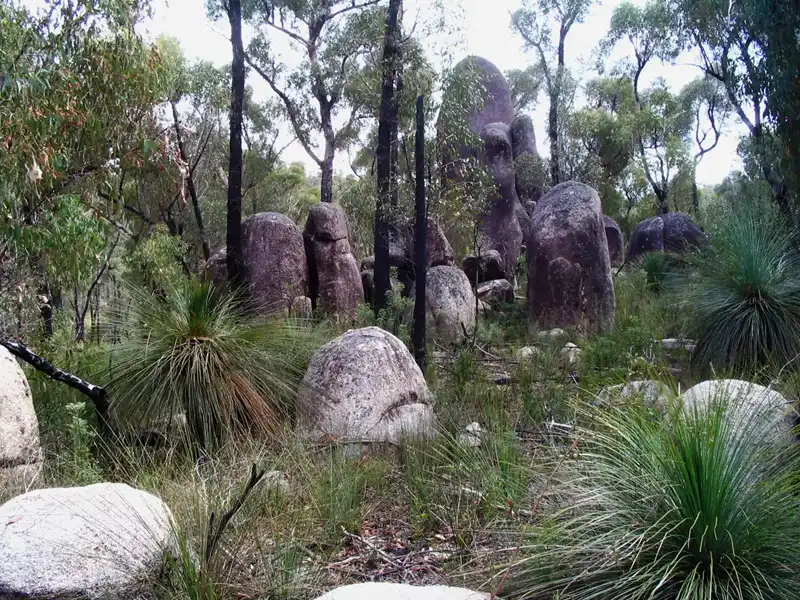
Bald Rock National Park is home to some incredible granite tors. These massive, free-standing boulders have been sculpted by the elements over millions of years into unique formations like natural arches and bridges.
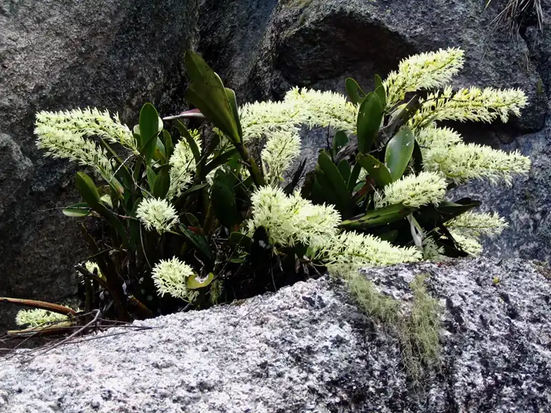
During our hikes in Bald Rock National Park, we found beautiful Rock Orchids. These ‘Rock Lilies’ are remarkably tough, thriving in the exposed, rocky conditions of the park. Their pale yellow flowers add a delicate touch to the otherwise wild and rugged

On the final leg of our journey from Lamington National Park, we made a quick stop at Crawney Pass National Park near Nundle to snap a photo of the striking grass trees before finishing our amazing trip.
Back to table of contents
More from NSW: South Coast