Best Hikes Near Hobart

Table of contents
- Things to do around Hobart on Non-Hiking Days
- Hike Mt Wellington (Kunanyi)
- Bruny Island Wildlife & Coastal Walks
- Hartz Mountains National Park
- Duckhole Lake & South Cape Bay Hikes
- Tasman Peninsula
Hobart – Gateway to Tasmania’s Great Walks
Why Choose Hobart as a Base for Hiking?
Hobart is an excellent base for exploring some of Tasmania’s most rewarding walks. If you are travelling from mainland Australia or overseas, you can fly directly into Hobart. If you bring your own car, the Spirit of Tasmania ferry arrives at Devonport, about a three-hour drive from Hobart.
Accommodation
Hobart offers a wide range of accommodation, from budget-friendly apartments and caravan parks to comfortable waterfront hotels. Summer, from December to February, is the busiest period, so booking ahead is advisable.
We have visited Hobart many times in February and often stayed 20–30 minutes outside the city, where we found some excellent accommodation. We particularly enjoyed staying in Huonville during cherry-picking season. On other trips, we stayed at caravan parks around Hobart, which worked well when travelling by motorhome.
Things to Do Around Hobart on Non-Hiking Days
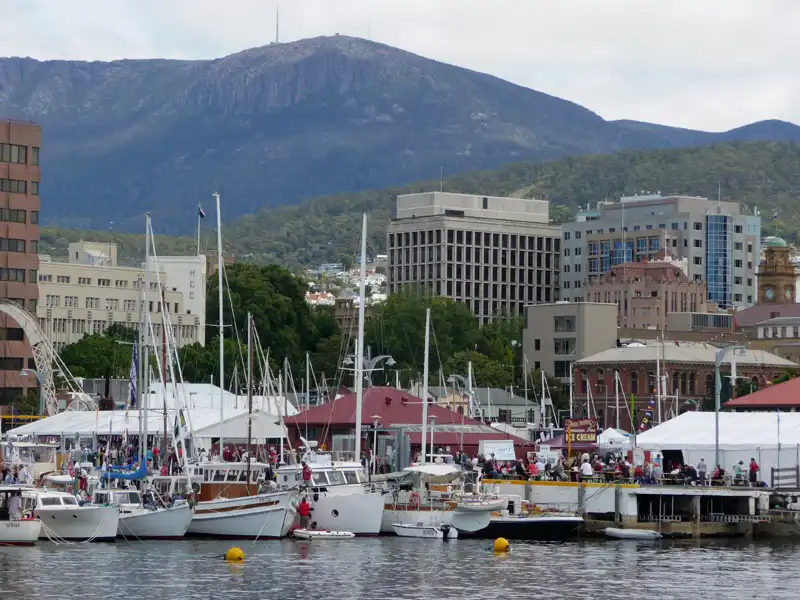
Hobart is also a great place to spend a day when you are taking a break from hiking. A visit to the historic Salamanca Market on the waterfront is a must. We also enjoyed MONA – the Museum of Old and New Art, a fascinating and sometimes wonderfully weird experience.
The Royal Tasmanian Botanical Gardens are another peaceful place to explore. If your legs need a rest after a hike, consider taking a day cruise. One of our favourites was the Bruny Island Wilderness Coast Eco Cruise.
Other places worth discovering include Battery Point, one of Hobart’s oldest residential neighbourhoods, and Cascade Brewery, Australia’s oldest operating brewery.
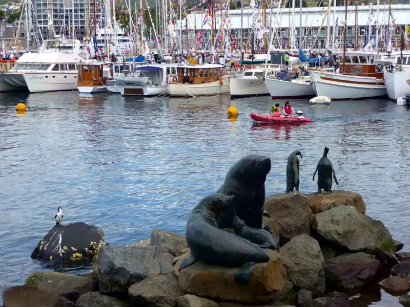
While in Hobart, the vibrant waterfront is a must-visit. Constitution Dock, home to part of Hobart’s fishing fleet, is not only used by fishing boats but also by personal yachts and various other vessels. This iconic area is best known as the finishing line for the annual Sydney to Hobart Yacht Race. We always have a walk along the waterfront to enjoy fresh seafood from the many stalls or dine at one of the excellent waterfront restaurants. You can also explore the nearby Salamanca Place, known for its charming shops and lively market, or visit one of Hobart’s historic buildings.
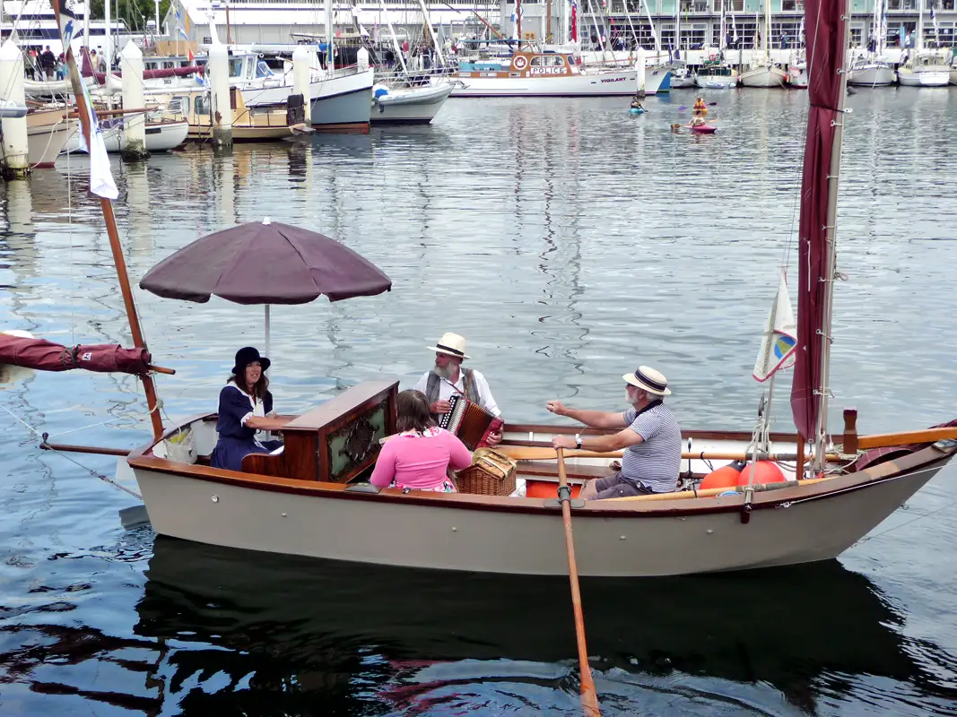
The Hobart Wooden Boat Festival is held every two years. When we were in Hobart during the festival, we enjoyed the historic tall ships, classic yachts, and all the other wooden boats.The show includes sailing competitions, exhibitions, and live music. It’s a lot of fun!

Whenever we’re in Hobart, a visit to the Saturday Salamanca Market is an absolute must. With over 300 stalls, it offers everything from fresh produce and artisanal foods to handmade crafts, clothing, and artwork. Moreover, the atmosphere is vibrant, thanks to street performers and live music that fill the air. Nestled among great pubs and beautiful heritage buildings, the market is also just a short stroll from the waterfront, making it a perfect starting point for a day out in the city.

The Clarence Jazz Festival in Hobart is a five-day annual event held at the Bellerive Waterfront. We loved listening to local and international bands while sipping a glass of wine and taking in the beautiful waterfront views. A highlight for us was always watching and listening to “George Washing Machine” and his band.
Back to table of contents
Mt Wellington (kunanyi): The Best Hike Near Hobart

Rising 1,271 metres above Hobart, kunanyi / Mount Wellington dominates the skyline and shapes the character of the city below. For us, it has always been more than just a backdrop — it’s a place of challenge, beauty, and unforgettable views.
Our favourite hike here is the Organ Pipes Circuit, a rewarding Grade 4, half-day walk that combines alpine scenery, dramatic dolerite cliffs, and sweeping views over Hobart and the River Derwent.
Later, when the steep climb became too demanding for us, we adapted. Instead of completing the full circuit, we walked to the Junction section and returned via the bicycle trail. It’s still a wonderful experience — proof that you don’t need to conquer the hardest section to enjoy the mountain.
Mount Wellington offers options for different fitness levels. The key is to choose a walk that suits you on the day.
Before you set out, always check the weather forecast. We’ve seen Mount Wellington covered in snow — even in summer. Snowfalls can occur in Wellington Park at any time of year, and conditions can change rapidly.
Be prepared:
- Wear sturdy footwear suitable for rocky terrain
- Carry warm, waterproof clothing
- Take sufficient drinking water
The walk begins at The Springs, located along Pinnacle Road at around 720 metres above sea level — about a 30-minute drive from Hobart. We’ve always managed to find parking here. If you don’t have a car, the kunanyi/Mt Wellington Explorer Bus is a convenient way to reach the mountain and enjoy the scenery without driving.
The Springs is well set up with:
- Picnic tables
- Toilets
- Gas-fired BBQs
- A café
After the hike, The Springs is also a good place to take a break. On the way back to Hobart, we always stop at The Fern Tree Tavern to celebrate a wonderful hike. Sitting down for a meal or drink after time on the mountain feels like the perfect ending to a day well spent outdoors.

The first section to Sphinx Rock Lookout is relatively easy. If you’re after a relaxed stroll rather than a demanding hike, this is a perfect option — about two hours return. The lookout platform offers magnificent views over Hobart and the Derwent Estuary.

Continuing on, you reach the historic Junction Cabins, a lovely rest stop surrounded by alpine vegetation. It’s a good place to pause before the more demanding section begins.
From Junction Cabins to The Chalet, the track becomes steep and rocky. This is the toughest part of the circuit, with sustained uphill climbing that will test your legs and lungs. Take your time and enjoy the scenery as you climb.
The Chalet marks roughly the halfway point and is an ideal place to take a proper rest before continuing.

From The Chalet, the track heads towards the spectacular Organ Pipes — towering dolerite columns that give Mount Wellington its dramatic character. The rugged upper section rewards hikers with panoramic views of Hobart before the trail gradually becomes easier on the descent back to The Springs.

The Organ Pipes are towering columns of dolerite, rising up to 120 metres high and formed by volcanic activity millions of years ago.
Bruny Island: Wildlife & Coastal Walks

There are many great hikes near Hobart, and Bruny Island makes an easy day trip from the city, with beautiful landscapes, coastal walks and plenty of wildlife. The island actually consists of two islands, North Bruny and South Bruny, connected by a long, narrow isthmus known as The Neck.
It takes about half an hour to drive from Hobart to Kettering, followed by a short ferry ride to Bruny Island. We decided to stay for two days because we wanted more time to look for the famous white wallabies and enjoy a wilderness boat cruise.
Bruny Island is a wonderful destination for hiking, exploring its wild coastline and enjoying some of Tasmania’s excellent local food.

Through a genetic mutation that affects melanin production, some Bennett’s wallabies on Bruny Island are born with a striking white coat. Their poor eyesight and sensitivity to sunlight make them more vulnerable to sunburn and skin cancers, yet they continue to thrive on the island, where there are few natural predators.
We stayed at Adventure Bay, a great base and one of the best places to look for these remarkable white wallabies.

We had only time for two hikes in Bruny.
- the 4 km return Grass Point Walk (1.5 hours, Grade 2) follows an easy coastal track from Adventure Bay. The mostly flat path passes open grassland and the ruins of an old whaling station. During migration season, southern right whales are often spotted offshore. Return via the same track.
- The 18 km Labillardiere Peninsula Circuit (5.5–6.5 hours, Grade 4) is a varied coastal walk on Bruny Island with sweeping ocean and mountain views. Expect long sandy beaches, quiet bays and abundant wildlife. A shorter 4.5 km loop is available. Bushwalking experience is recommended for this rewarding full-day hike.

During our short stay on Bruny Island, we spotted quite a variety of wildlife. While hiking, we saw several Tasmanian pademelons, which are smaller and stockier than Bennett’s wallabies. We also came across numerous echidnas, sometimes known as spiny anteaters, foraging along the tracks.

The highlight of our trip was a fantastic 3-hour Wilderness Cruise with the award-winning Pennicott Wilderness Journeys. Aboard a custom-built boat carrying a maximum of 43 passengers, we cruised alongside some of Australia’s highest sea cliffs, searching for coastal wildlife. We were thrilled to spot seals, dolphins, and a variety of seabirds during the cruise. It was, without a doubt, the best wildlife experience we’ve ever had—thanks in large part to the exceptionally skilled and incredibly helpful crew.

The Bruny Island coastline is spectacular, with towering cliffs, deep caves, and dramatic rock formations. One of Bruny Island’s natural wonders is Breathing Rock, a coastal blowhole visible only from the water. To me, this impressive rock looks like a medieval statue with a crown.

During the cruise, we spotted sea eagles, albatrosses, and playful dolphins. However, the true highlight was spotting Australian fur seals basking in the sun, lounging on the rugged rocks and enjoying the warmth of the day.
Back to table of contents
Hartz Mountains: Alpine Hikes Near Hobart
Hartz Mountains National Park is a stunning wilderness area located around 80 km south-west of Hobart. The park is famous for its breathtaking alpine scenery, ancient forests, and glacier lakes. There are several wonderful hiking trails ranging from easy to difficult.

During our many trips to Tasmania, we explored Geeveston in the south, just an hour’s drive from Hobart. We stopped by the charming Geeveston Town Hall Visitor Centre before heading up to our beloved Hartz Mountains. If hiking isn’t your thing, you can drive to the Tahune Airwalk, where you’ll be able to walk 50 meters above the forest floor and take in breathtaking views.

The flora of Hartz Mountains National Park is both diverse and unique. Visitors can explore vibrant alpine heath, Button Grass, lush fern gullies, and a stunning array of wildflowers in all colours during the summer months.

Although we didn’t reach the summit of Hartz Mountains (1254m), we hiked to enjoy the breathtaking panoramic views along the way.

The Lake Osborne Trail is one of our favourite hikes. This fascinating 45-minute walk takes you through a rainforest of myrtle, sassafras, and pandani. Along the way, you’ll pass impressive large boulders known as the Devil’s Marbles. The lake itself is stunning, with crystal-clear waters, and ancient King Billy pines lining the edge. It’s the perfect scenery for a photoshoot.
Back to table of contents
Duckhole Lake & South Cape Bay Hikes

After visiting Hastings Caves and a dip into the thermal springs, we went to Duckhole Lake. The trail is located just south of Dover, but not easy to find. The 4.2km track, most of which is boardwalk, follows a stream through regrowth forest to the lake. If you are lucky, as we were, you can spot Platypus in the stream.

The lake is actually a flooded sinkhole. While enjoying a picnic, we listened to the songs of birds and the croaks of frogs. The water’s surface was like a mirror, perfectly reflecting the surrounding trees. a flooded sinkhole. While enjoying a picnic, we listened to the songs of birds and the croaks of frogs. The water’s surface was like a mirror, perfectly reflecting the surrounding trees.

From Huonville we drove to Cockle Creek, which takes about 1.5 hours, to hike the South Cape Bay trail. When we arrived, we were fortunate to see a spotted-tailed quoll, also known as a tiger quoll near the creek.

The 16-kilometre return hike to South Cape Bay is a moderately challenging walk and the southernmost day hike you can do in Australia. The trail begins with an easy stroll through woodlands and marshlands, much of it on boardwalks. As you approach the ocean, the terrain becomes hillier, adding a touch of challenge. After the long hike, we arrived at the cliff, from where we had stunning views of South Cape Bay, with the striking Lion Rock to the right.
Back to table of contents
Tasman Peninsula: Great Day Hikes Near Hobart
Among the many hikes near Hobart, the Tasman Peninsula is a beautiful area roughly 90 kilometres from the city. It’s a popular site for both nature and history lovers. The Tasman National Park is famous for its high sea cliffs, rock formations like the Tasman Arch and Devil’s Kitchen, and scenic hikes.

The Cape Raoul track is a 14 km (5-hour) return walk, rated Grade 4. While the cliffside ocean views provide an immediate highlight, the trail continues past the initial lookout. Despite the tempting lunch spot, it is worth completing the final steep climb to reach the seal colonies at the tip of the cape.

We did another hike on the Peninsula — the 9.4 km Cape Hauy track (about 4 hours, Grade 3). The trail winds through woodland and heath before dropping down steep stone steps and then climbing again toward the cape. From the lookout, we watched massive dolerite columns plunge into the ocean and spotted sea eagles gliding over the water.

While exploring the Tasman Peninsula, we came across the TESSELLATED Pavement. At first glance, looks like a carefully laid tiled floor. But it’s a stunning natural formation shaped by geological processes over time.

Near Eaglehawk Neck, you’ll find three remarkable natural attractions: the Tasman Arch, the Blowhole, and Devil’s Kitchen.
View of Tasman Peninsula coastline.
Back to table of contents