Cradle Mountain and Mount Field: exploring and hiking
Mount Field National Park
We loved going to Mount Field National Park, it’s a fantastic destination for hiking and camping. The park is just a two-hour drive from Hobart and is part of the Tasmanian Wilderness World Heritage Area. We enjoyed seeing and taking photos of some of the world’s tallest eucalypt forests and cascading waterfalls. Hikes, ranging from easy walks to challenging treks, we did most of them. In the park is a visitor centre with a caf , picnic areas, a children’s playground, and a campground. For non campers there are other accommodation options close by.

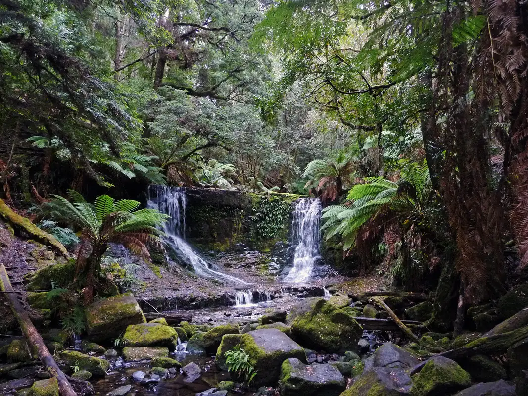
During our many trips to Tasmania, we visited Mount Field every time. Our journey always began with Russell Falls, Tasmania’s most beloved waterfall. Standing in the lush, moss-covered forest, we were always in awe as the water cascaded over multiple levels. The walk to the falls is an easy 25-minute stroll through the forest from the visitor centre. Twice, we were lucky to spot a platypus in the nearby creek. At night, the magic continued as glow worms lit up the vegetation near the falls, creating a truly enchanting experience.
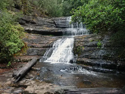
Horseshoe Falls is a short but steep 15-minute climb from Russell Falls. Though smaller, it is often considered even more beautiful. From there, you can either return to the Mount Field Information Centre or continue on the scenic 6 km circuit (approximately 2.5 hours). The trail takes you through the majestic Tall Trees Walk, home to towering swamp gums, before leading to Lady Barron Falls—a charming, cascading waterfall nestled in lush rainforest.

The Tall Trees Walk is a must if you visit Mount Field. Hiking among those swamp gums, the tallest flowering plants on Earth is a beautiful experience. They can live for hundreds of years (provided they aren’t chopped down for wood chips) and reach heights of over 100 metres.
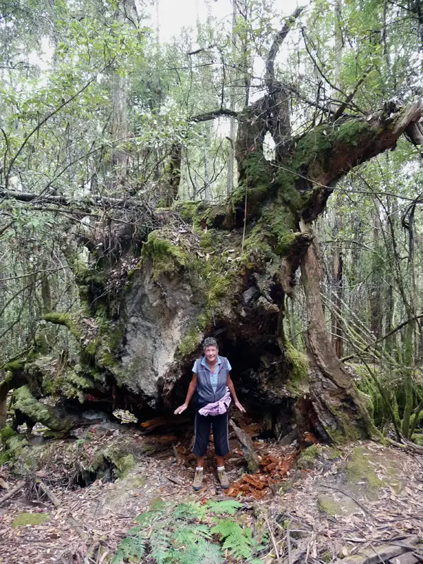
The roots of the swamp gums at Mount Field are massive.
Lady Barron Falls is the third waterfall on the circuit, with a height of around 8 metres. To return to the information centre, you’ll need to climb a long staircase with hundreds of steps. If steep staircases are a concern, consider starting the circuit clockwise from the information centre to walk down the steps at the beginning of the circuit.
Hikes from Lake Dobson
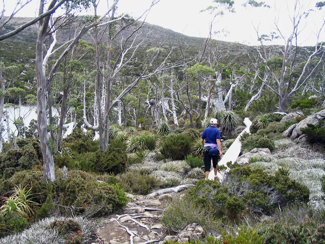
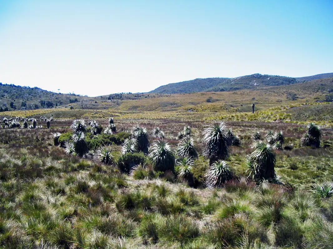
A fantastic hike is Pandani Grove, we have done this on every visit to Mount Field. Even if it is a bit difficult to reach. To get there you have to drive (or walk) along a rugged 15 km dirt road that climbs nearly 1000 meters to Lake Dobson. We always drove there. Once there, we hiked the easy 1.5 km circuit around the lake, which is a peaceful walk through a stunning subalpine landscape. Along the way are the pandanis and other remarkable plant species, as well alpine gums, soft tree ferns, and pencil pines. If you’re lucky, you might even spot the elusive platypus,
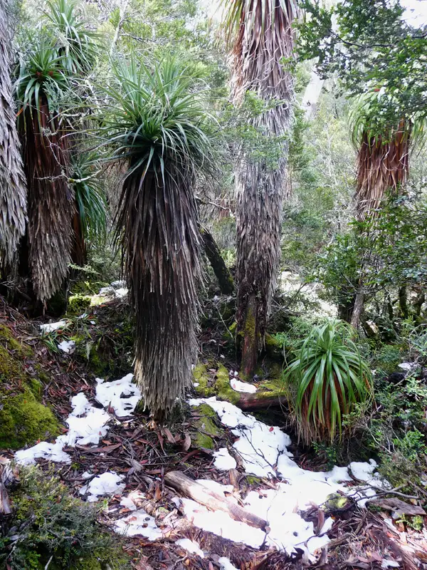
Pandanis, can reach a height of 12 metres are the world’s tallest heath. Can be found only in Tasmania’s alpine and wet forest mountains, and nowhere else on Earth. Even in the summer you can find snow at Lake Dobson.

The Tarn Shelf Circuit was our favourite hike in Mount Field National Park. From Lake Dobson, we went uphill to the ski fields, and then to Tarn Shelf, Lake Newdegate, Twilight Tarn, and Lake Webster. Then back to Lake Dobson. The circuit is 12 km long and it took as 7 hours to complete. Even though some sections are rough and muddy, it is a fantastic hike.

We hiked from Lake Dobson to Mount Field West, which is 1,434 metres above sea level. The track is Grade 5, 17 kilometres long, and extremely rough and steep. It took us 8 hours to get back home. The Tarn Shelf walk was fantastic, but the Mt Field West walk was not.
Lake St Clair
Whenever we drove through Tasmania, we would spend several days at Lake St Clair. The lake is calm and The Aboriginals called it Leeawuleena, meaning “sleeping water.” It’s Australia’s deepest freshwater lake and is in the Cradle Mountain-Lake St Clair National Park.It marks the endpoint of the iconic Overland Track, a multi-day hike through Tasmania’s wilderness. Though we’re no longer as young as we once were, we are proud to have completed the first part of the track and to have hiked its final section many times.
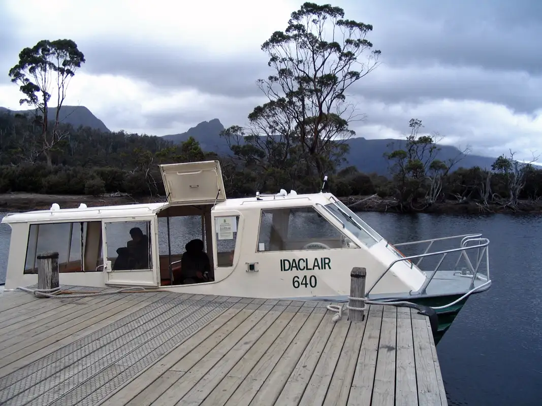
We took the 20-minute ferry from Cynthia Bay to Echo Point Walker’s Hut. From there, we hiked the last section of the famous Overland track. The 11-kilometre hike took us 5 hours to get back to Cynthia Bay. The track has some steep sections and a rough surface. It is mostly through rainforest and close to the lake. Understandably, some Overland Track hikers choose the ferry return attracted by having a hot shower, comfortable bed, and a good meal.
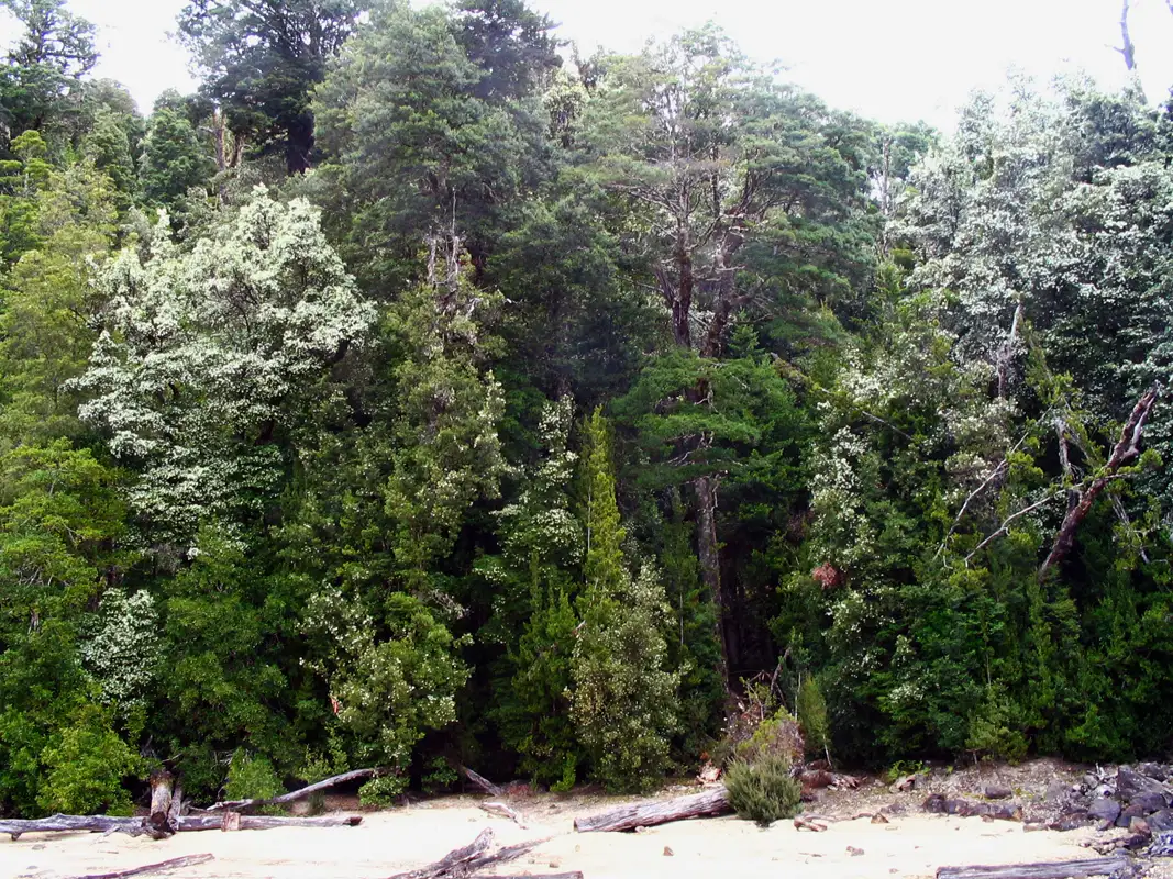
We enjoyed staying in St. Claire,peaceful with abundant wildlife. We watched wallabies, pademelons and wombats. Once we spotted even the elusive platypus. We loved the smell of the large gum trees and the blooming Leatherwood trees. We stayed there in our motorhome and sometimes in nice cabins. There is also a great restaurant for feeding the hungry bushwalker.
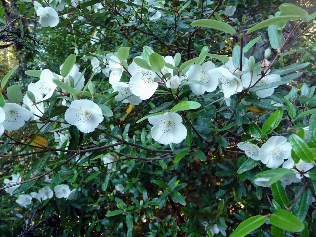
The Leatherwood flowers are beautiful and the bees do a good job making delicious honey out it. We always make sure to buy Leatherwood honey from Stephens at Mole Creek before we get home.
Nelson Falls, Franklin-Gordon Wild Rivers National Park

On our drive from Derwent Bridge to Queenstown, we made a stop for a short walk to Nelson Falls in the Franklin-Gordon Wild Rivers National Park. At the trail we had a glimpse of the surrounding wilderness. At the path were beautiful sassafras, myrtle trees, and ferns. We love squeezing the sassafras leaves, they release a spicy scent.

When we walked to the Nelson Falls, there wasn’t much water cascading down the 30-meter drop into the Nelson River. Despite that, the falls were still incredibly impressive.
Montezuma Falls
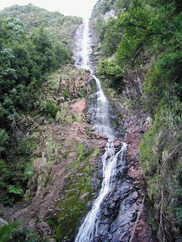
The Montezuma Falls near the town of Rosebery on Tasmania’s West Coast, is truly amazing in many ways. Firstly, it was named after Montezuma (1466 1520), the Aztec emperor of Mexico, because the Silver Mining Company that held the lease was called Montezuma. Secondly, the track follows the path of a former tramway, adding a historical touch to the hike. Lastly, with a 104-meter drop, Montezuma Falls is the tallest waterfall in Tasmania, and the track takes you right to the base, gives a stunning view of the falls.
The Montezuma Falls is near the town of Rosebery on Tasmania’s West Coast. The track to the falls follows the path of a former tramway, which was built by Silver Mining Company. The company was named after Montezuma (1466 1520), the Aztec emperor of Mexico. That’s where the falls got the name. That’s where the falls got the name. The hike is an easy, graded 2.12 km loop, it took us about 3 hours walking through lush rainforest.

From the bridge, we had stunning views of the falls which dropped 104 metres. That makes the Montezuma Falls to the tallest waterfall in Tasmania.
The Montezuma Falls
Cradle Mountain
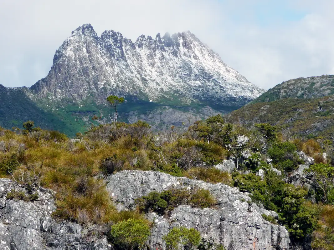
Cradle Mountain-Lake St Clair National Park is a must-visit when in Tasmania. Its highest peak, Cradle Mountain, stands at 1,545 meters (5,069 feet) above sea level. It’s a fantastic place for hiking, whether you’re on a gentle stroll or a challenging hike.
It’s a paradise for hikers, photographers, and nature lovers alike. We went there many times. Enjoyed both easy and challenging hikes. We loved the wildlife, spotting wombats, quolls, and pademelons. There is an excellent tourist center with a great shuttle bus through the park and helicopter flights over the area. A variety of accommodations, a campground, a wilderness village and cabins. There are restaurants and taverns where we had drinks after a long hike. In addition, there is a wildlife center where you can see Tasmanian devils.

There’s the Cradle Mountain Valley Boardwalk, which runs from the Ranger Station to Ronny Creek. We have done this fantastic 11-kilometer walk many times. Sometimes we hiked the entire boardwalk or we did only sections of it. The shuttle bus also makes it very easy to explore different parts of the trail.
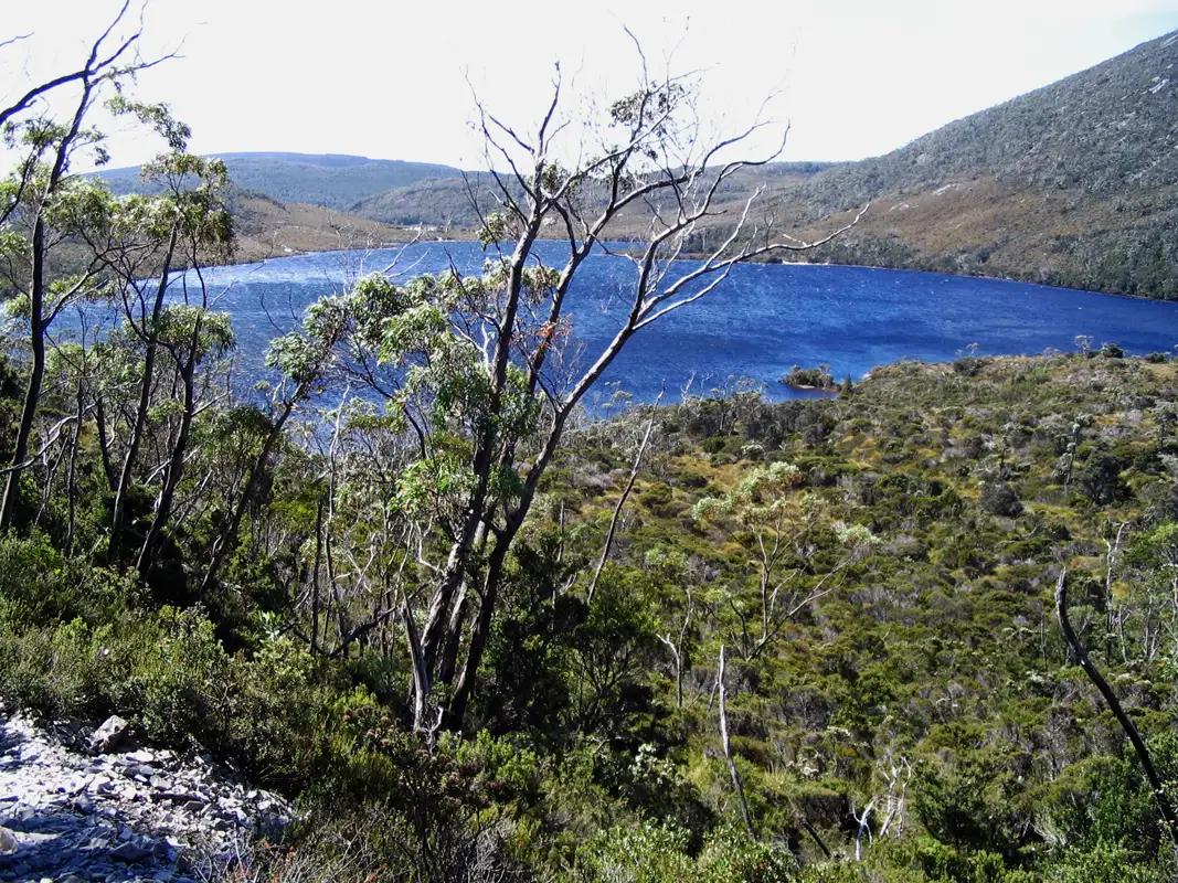
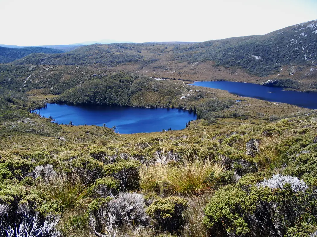
Whenever we visit Cradle Mountain, the Dove Lake Circuit is a must-do for us. It’s the perfect hike for those who may not be extremely fit, but still want to enjoy the beauty of the area. This Grade 3 walk takes 2 to 3 hours and includes some steep sections, boardwalks, and gravel paths. Along the way, there are breathtaking viewpoints offering stunning views of the mountains and the lake. No wonder this is the most popular walk at Cradle Mountain!
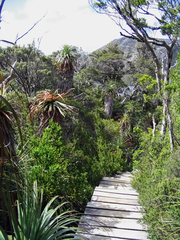
We loved walking through the cool temperate rainforest of ‘The Ballroom Forest,’ surrounded by myrtle, King Billy pines, and sassafras. It felt like walking through a cathedral. Along the circuit, we also spotted pandanis, the world’s tallest heath, reaching heights of up to 10 metres.
Another delightful walk we enjoyed started with the shuttle bus drop-off at Ronny Creek. From there, we walked through the button grass area, where wombats are often spotted, before reaching the beautiful Lake Lilla. A little further along, we arrived at Dove Lake to complete the circuit. It’s a scenic and hike off a wonderful mix of landscapes.
The hardest hike for us, as “oldies”, was to Marion’s Lookout. We started from Ronny Creek, passed the Wombat Pools and continued up to Marion’s Lookout.
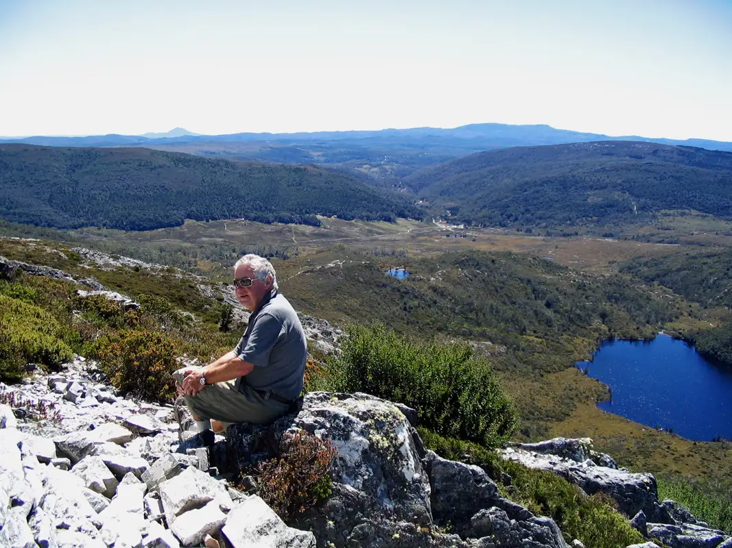
The Marion’s Lookout walk (1,223 meters) can be challenging in parts. There’s a particularly steep and slippery section. Which may not be suitable for young children or the older hikers —except for us, of course! However, the effort was well worth it, from the lookout, we had stunning views of Lake Lilla, Wombat Pools, and Ronny Creek.
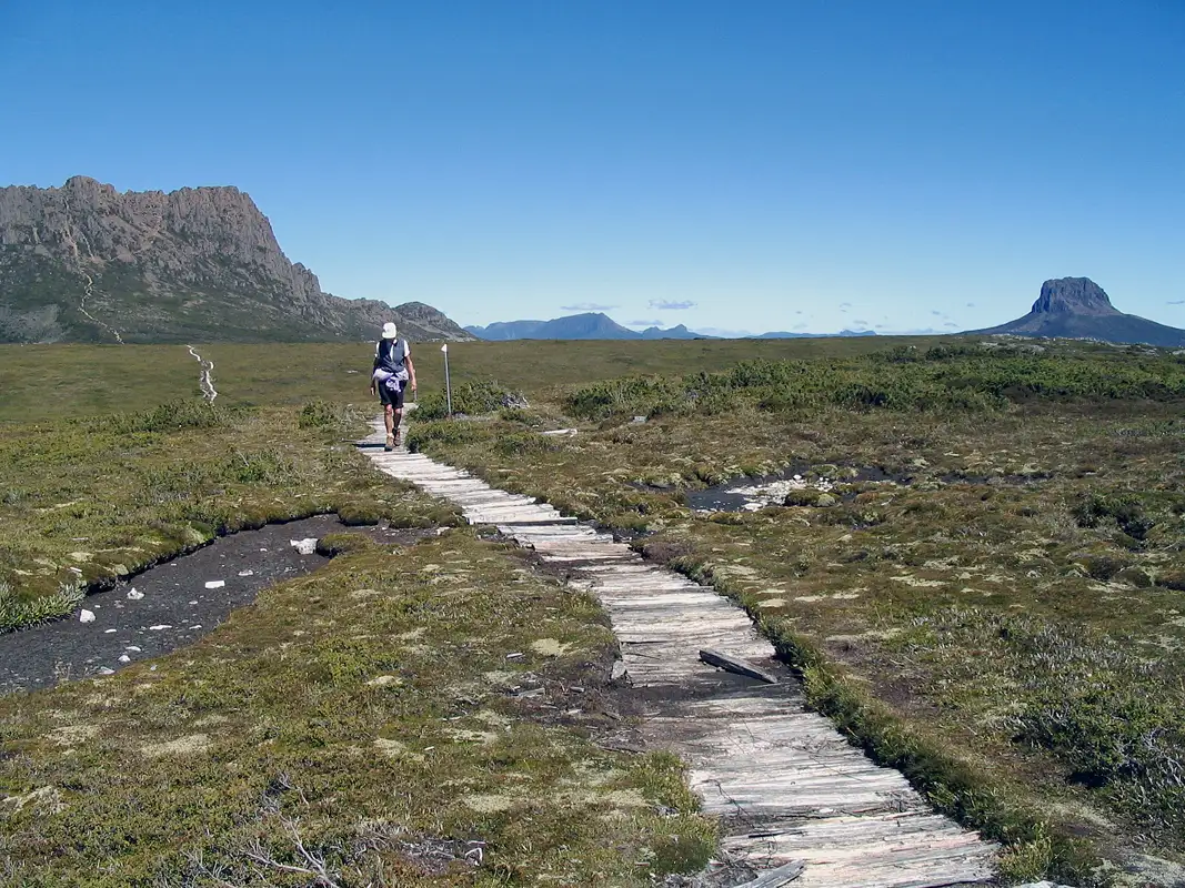
From Marion’s Lookout, we followed the Overland Track to Kitchen Hut where we had a break. Along the way, we had a fantastic view of the iconic Bluff Barn. A picturesque spot that’s often photographed from every angle. Then we descended via the Horse Track.
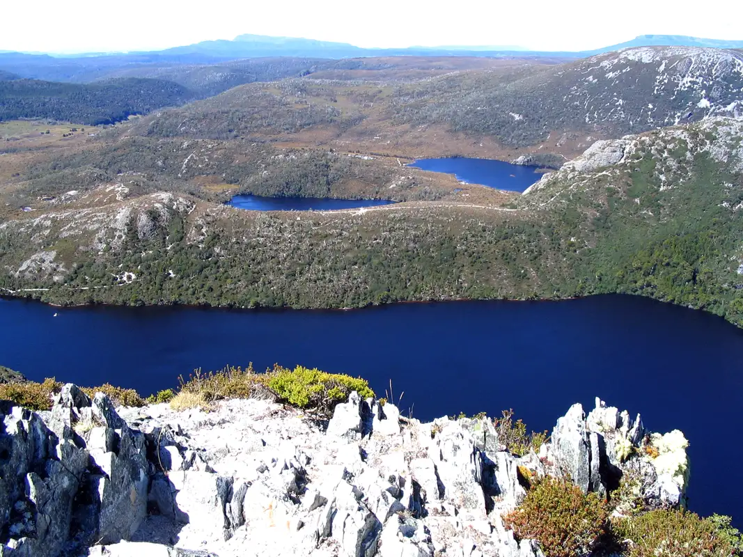
This is the spectacular view of Crater Lake, Lake Lilla, and Dove Lake from Crater Peak. We hope we convince anyone that the Marion’s Lookout hike is worth doing it.
More from Tasmania: East and West Coast
More from Tasmania: Hobart and South