
Exploring Australia’s Red Centre: Uluru, Kata Tjuta Walks & Iconic Hikes
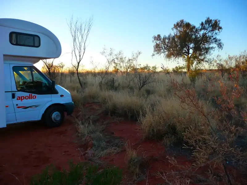
We flew to Australia’s Red Centre and rented a motorhome in Alice Springs, beginning an unforgettable journey through the heart of the country. Along the way, we explored the iconic Uluru (Ayers Rock), the striking domes of Kata Tjuta (the Olgas), and the breathtaking landscapes of Kings Canyon. Hiking was a highlight of this trip, with memorable walks and scenic trails in both the West and East MacDonnell Ranges revealing the raw beauty of Australia’s outback.
Table of contents
- Uluru (Ayers Rock)
- Kata Tjuta (The Olgas)
- Kings Canyon
- MacDonnell Ranges
- East MacDonnell Ranges
- Palm Valley
Uluru (Ayers Rock)
Uluru, also known as Ayers Rock, is a massive sandstone monolith in the heart of Australia. This iconic landmark is not only a natural wonder but also a place of deep cultural and spiritual significance for the Aboriginal people, who regard it as a sacred site.
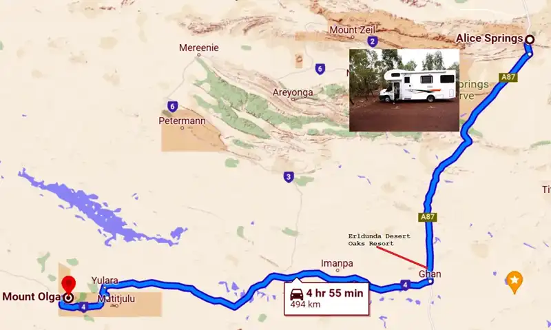
We spent the first three days in Alice Springs exploring the Araluen Cultural Precinct, where we were impressed by the stunning paintings of Albert Namatjira. We also visited the Desert Park and the historic Telegraph Station. Alice Springs is a nice town, but we were saddened by the sight of many homeless Aboriginal people wandering the streets. Before heading to Uluru, we stocked up on groceries, with our first stop being the Desert Oaks Resort in Erldunda, where we stayed overnight.
Sunset at Uluru in Australia’s Red Centre

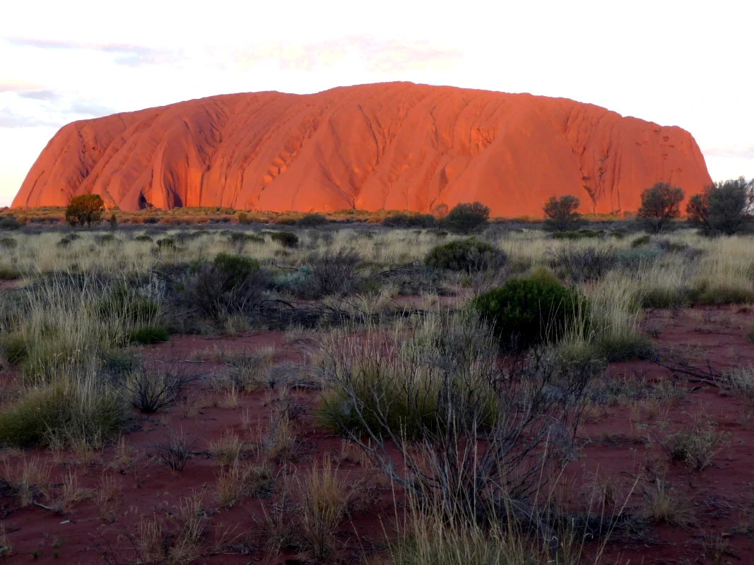
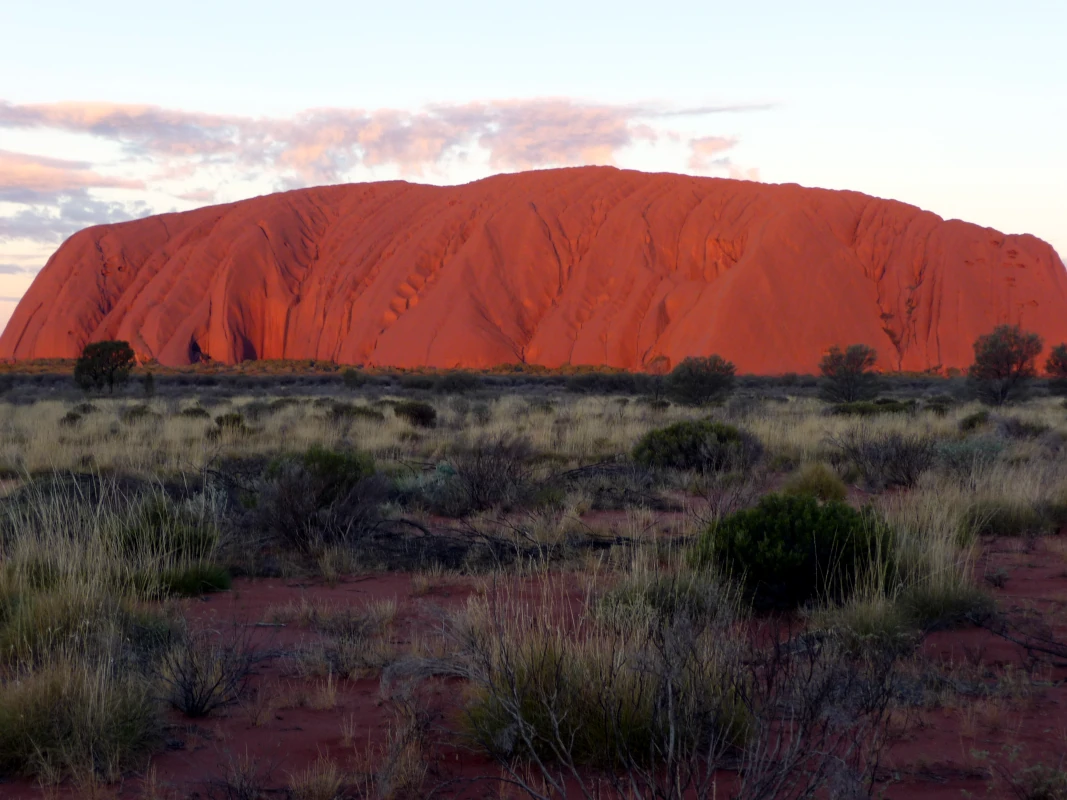
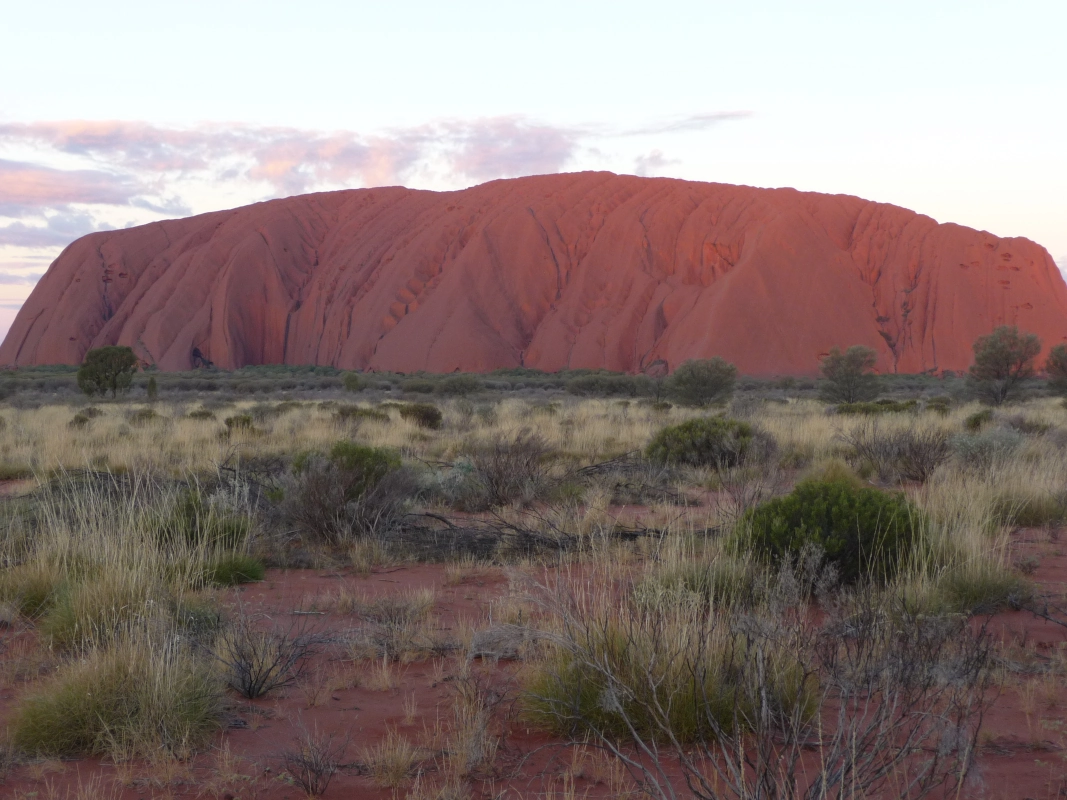
On our first evening in Uluru, we watched the dramatic sunset over this iconic monolith in Australia’s Red Centre. It’s essential to arrive early, as the viewing areas can get quite crowded. Don’t forget a bottle of bubbly to make the experience even more special! As the sun dips, Uluru transforms, shifting from soft pink tones to vivid shades of orange and red.
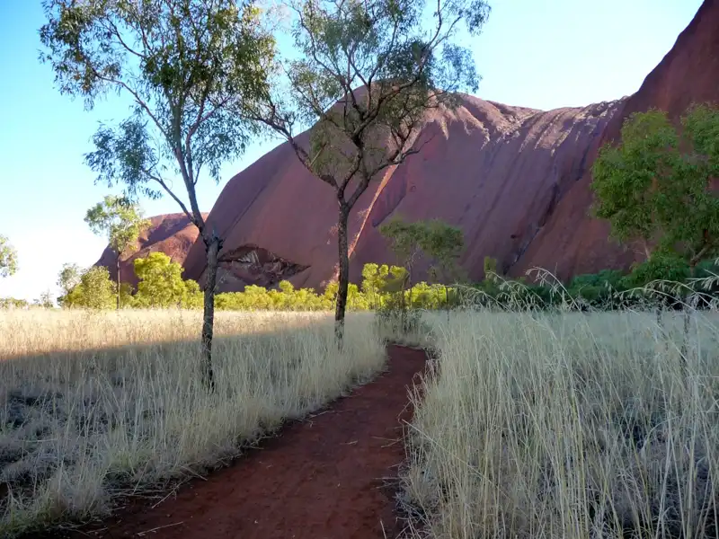
Instead of climbing Uluru, we chose to walk around its base. The 10.6 km Base Walk is a scenic trail encircling the monolith, taking about three to four hours to complete. Along the way, we admired Uluru’s ever-changing textures and colors, as well as the sacred Aboriginal sites that make this trail so special.
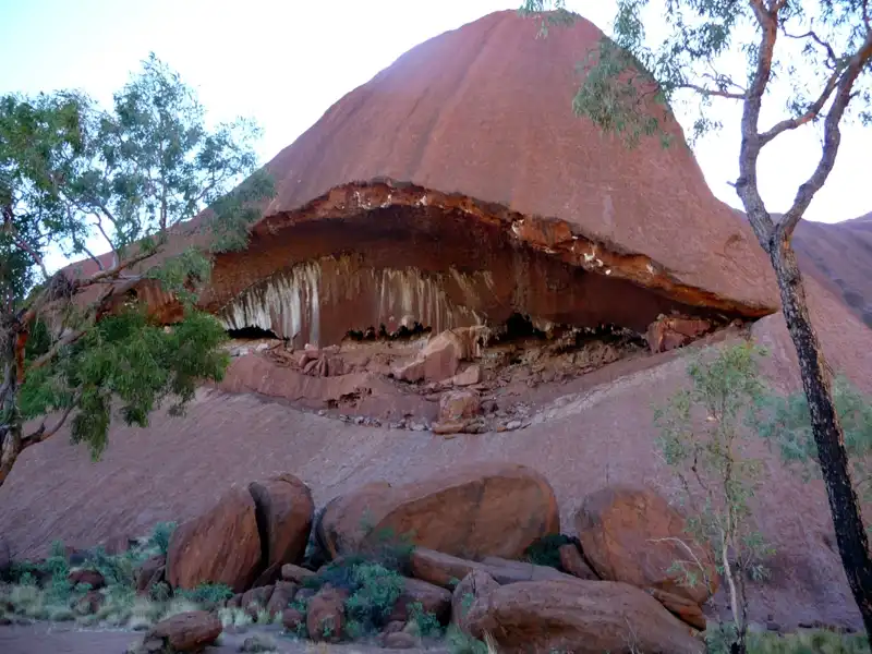
Uluru’s massive rock formations were originally a dull grey, but over thousands of years, rain and weather gradually washed away the surface minerals. The high iron content in the rock oxidized, giving Uluru its signature deep red hue. Inside the rock, large caves and overhangs reveal even more of the stunning red tones, offering a glimpse into the geological history of this iconic monolith.
Back to table of contents
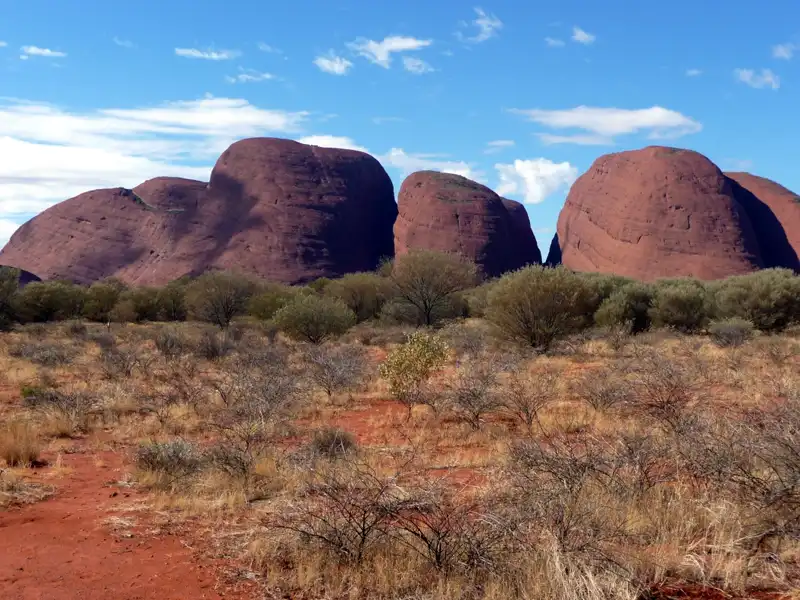
Kata Tjuta (The Olgas)
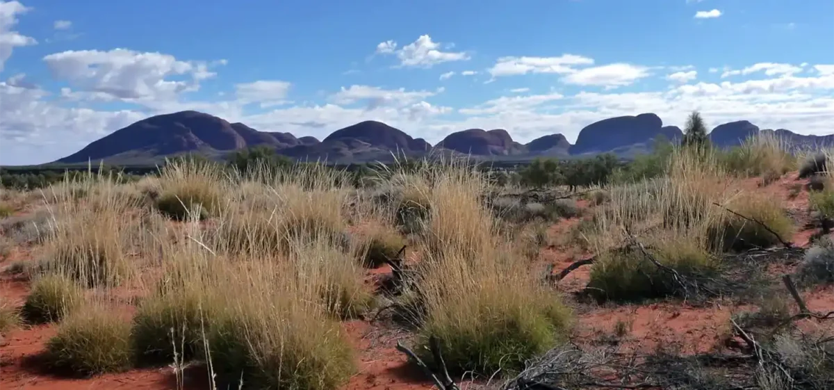
Kata Tjuṯa, also known as The Olgas, is a powerful and deeply spiritual landscape in Australia’s Northern Territory. Sacred to the Anangu people, these ancient domed rock formations are especially striking at sunrise and sunset, when the changing light brings out rich reds and ochres. Beyond its beauty, Kata Tjuṯa offers some of the most rewarding hikes in Australia’s Red Centre.
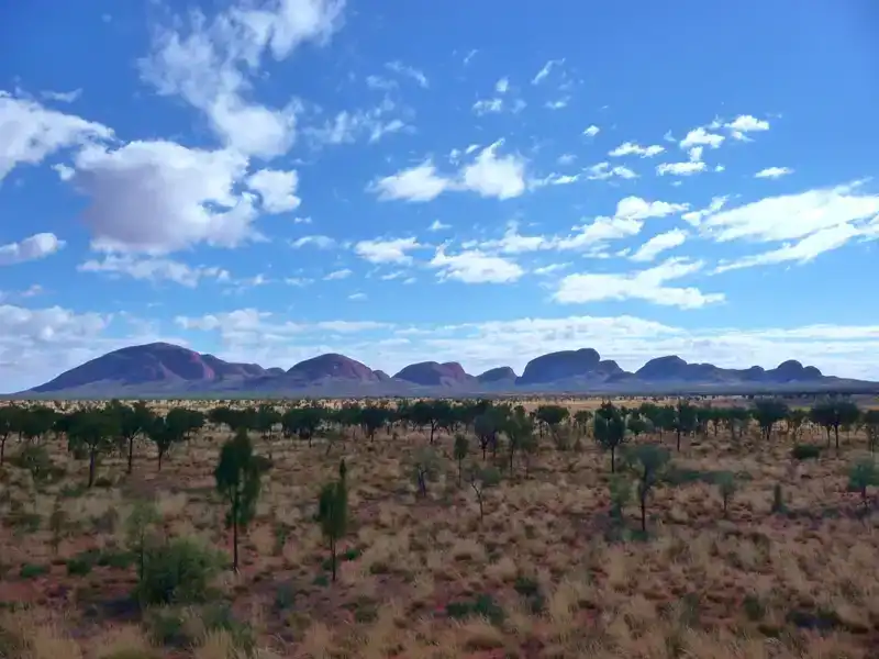
From Uluru, we took a day trip to Kata Tjuṯa (The Olgas), a dramatic group of 36 massive domes rising from the desert plains. Taller and more imposing than Uluru, the highest point reaches 546 metres above the surrounding landscape, creating a sense of scale that is both humbling and unforgettable.
From the car park, the view of Kata Tjuṯa is immediately impressive. From here, there are two walking options to explore the area:
- Valley of the Winds Walk – A more demanding 7.4 km Grade 4 circuit. This 3–4 hour hike features steep, rocky sections and a total elevation gain of 328 m, rewarding hikers with spectacular views.
- Walpa Gorge Walk – A 2.7 km return walk leading into the towering rock walls of the gorge. This is an easy walk with a gentle 143 m elevation gain, taking about 1–1.5 hours.
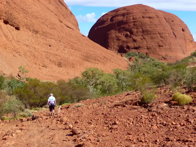
We chose to hike the Valley of the Winds trail. In our early seventies, it was a tough challenge, with steep, rocky climbs, but the effort was rewarded with stunning panoramic views. The walk passes through culturally sensitive areas where photography is restricted. Starting early, wearing sturdy boots, and carrying plenty of water are essential. We took much longer than expected, but we managed the hike and truly enjoyed the experience.
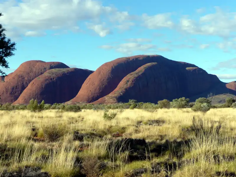
Before leaving, we took one final photo of Kata Tjuṯa from the dune viewing area, where the sweeping panorama of the domes provided a perfect and memorable farewell.
Back to table of contents
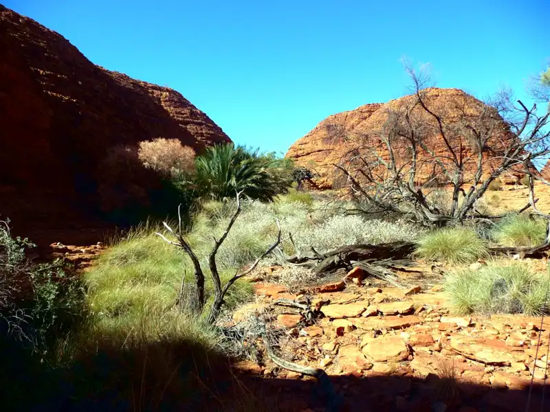
Kings Canyon
Deep in the heart of Australia’s ‘Red Centre,’ Kings Canyon is a majestic ancient canyon carved into the desert landscape of Watarrka National Park. Located approximately halfway between Alice Springs and Uluru, it is a place of dramatic contrasts—where ancient, sun-scorched sandstone cliffs drop 100 meters into hidden, lush palm forests.
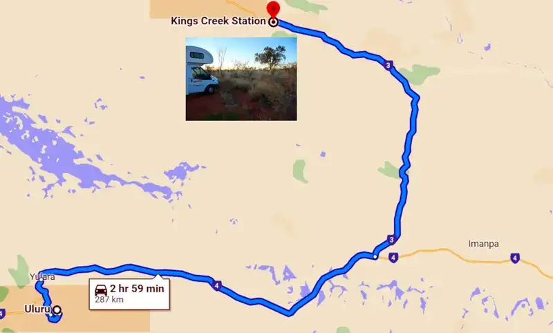
From Yulara, we drove to our next destination Kings Creek Station, which is a three-hour drive.
We spent three days at Kings Creek Station, staying in a secluded spot with our motorhome, and thoroughly enjoyed the tranquillity of the outback. This working cattle station near Kings Canyon offers a range of accommodation options, a welcoming café, and a well-stocked station shop. Guests can choose from a variety of activities, including guided quad bike tours, camel safaris, and scenic helicopter flights. It was an unforgettable experience and the perfect base for exploring the breathtaking trails of Kings Canyon.
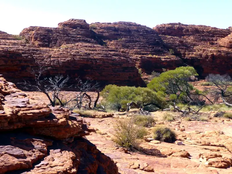
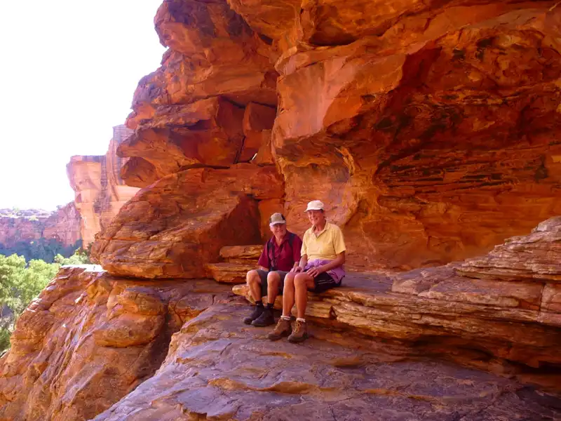
If you enjoy hiking, the Kings Canyon Rim Walk is a bucket-list adventure.The trek takes around three to four hours to complete and begins with a steep climb of about 1,000 steps, known as Heartbreak Hill. Once you reach the top, the remainder of the trail is relatively easy and rewards you with breathtaking panoramic views over the canyon and surrounding outback.
After reaching the top, you’ll wander through the Lost City, a striking formation of weathered sandstone domes. Smaller than the famous Bungle Bungles, this remarkable landscape resembles the ruins of an ancient city shaped by time and erosion.
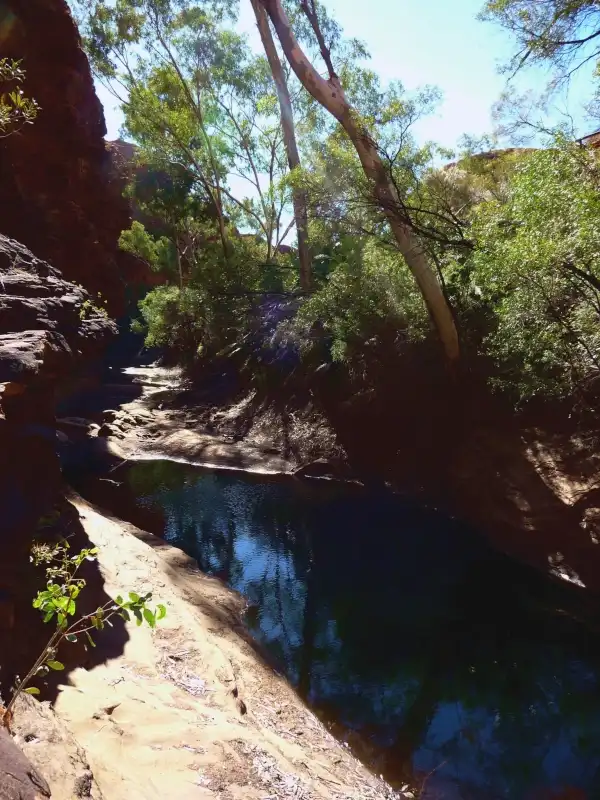
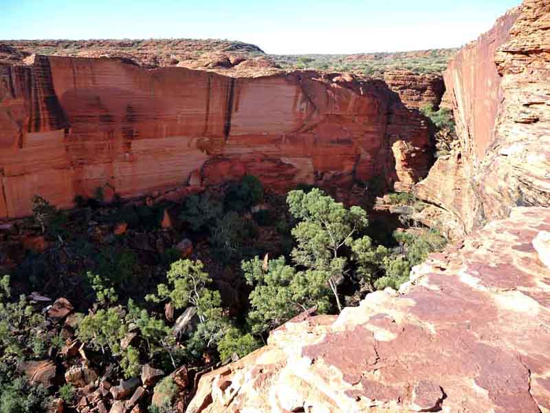
Later, we followed a side trail down a steep staircase, leading to the Garden of Eden a stunning waterhole surrounded by lush greenery.
After completing the most challenging section of the walk, we stopped for a well-earned rest and took in the magnificent view over Kings Canyon Valley.
On the way back, we enjoyed the spectacular views across the canyon valley as we looked up toward the rim where we had hiked earlier.
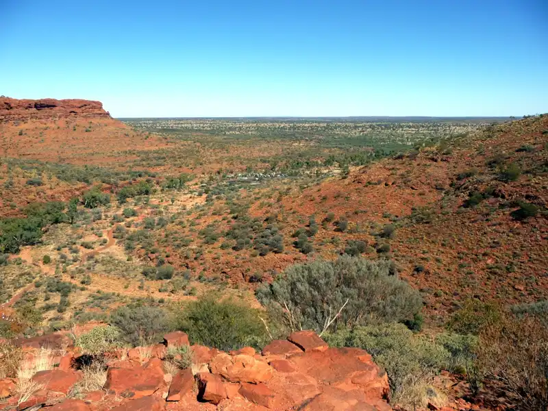
Our final view of the stunning Red Centre was unforgettable. The vast outback landscape stretched endlessly toward the horizon.
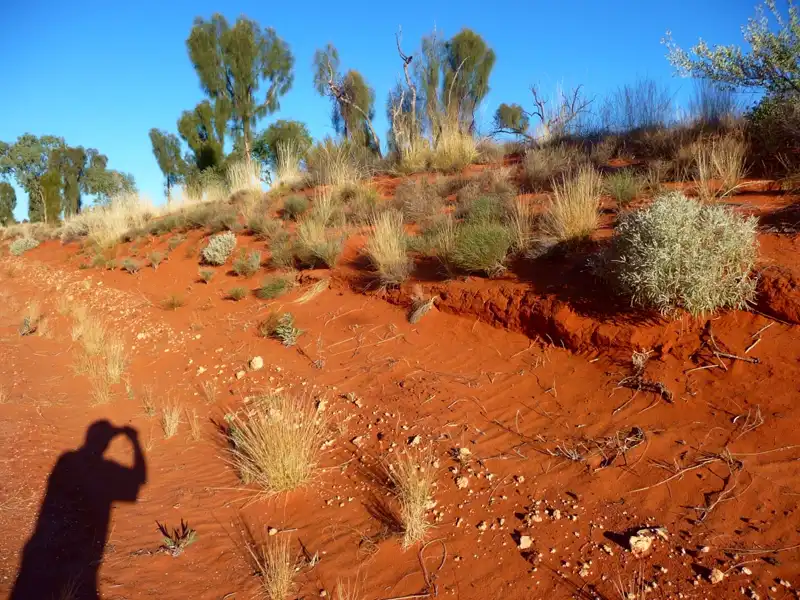
Endless red sand dunes and hardy desert flora—this is the essence of Australia’s Red Centre. One look at this photo and you’ll understand exactly how it got its name.
Back to table of contents
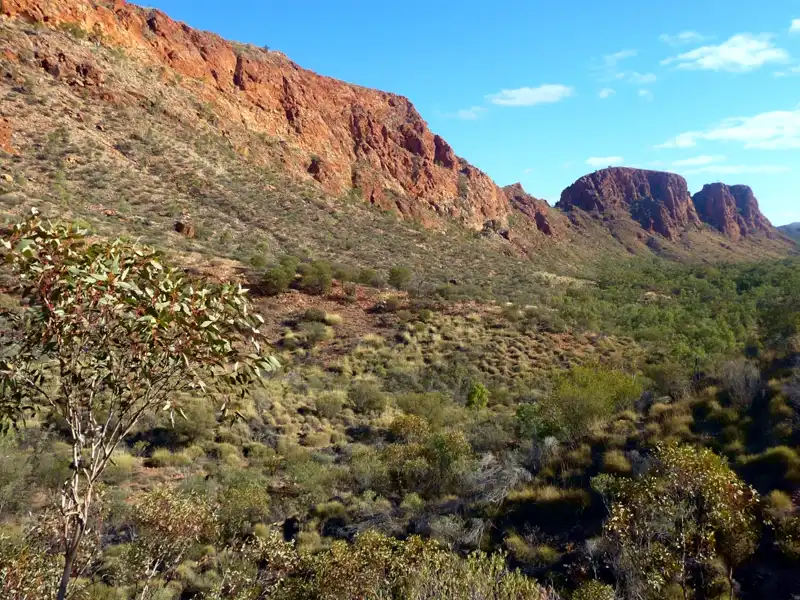
West MacDonnell Ranges
The West MacDonnell Ranges are a breathtaking mountain range stretching more than 160 kilometres west of Alice Springs. This vast, ancient landscape is defined by dramatic red quartzite ridges, deep gorges, narrow chasms, and permanent waterholes. Renowned for hiking, camping, and photography, the ranges also hold profound cultural and spiritual significance for the Aboriginal people of the region.
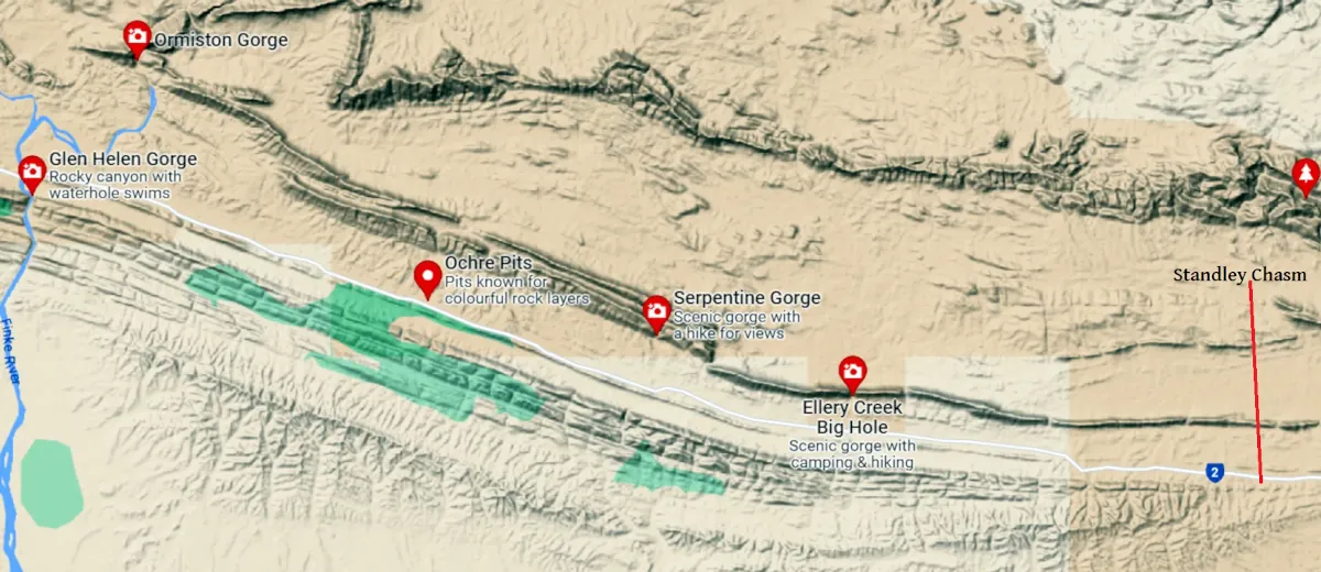
We drove from Alice Springs To Glenn Helens and on the way we explored most of their iconic places.
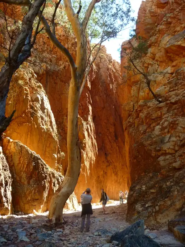
Don’t miss Standley Chasm in Australia’s Red Centre. A short and easy 1.2-kilometre walk leads into this narrow gorge, where the real magic happens around midday. At that time, sunlight pours into the chasm, setting the towering rock walls ablaze with intense reds and glowing orange tones.
Even at midday, the track remains mostly shaded, making the walk cool and pleasant. The trail is lined with lush vegetation, including gum trees, ferns, cycads, and wildflowers. With a bit of luck, you may also spot local wildlife, such as a wallaby or even a dingo, along the way.
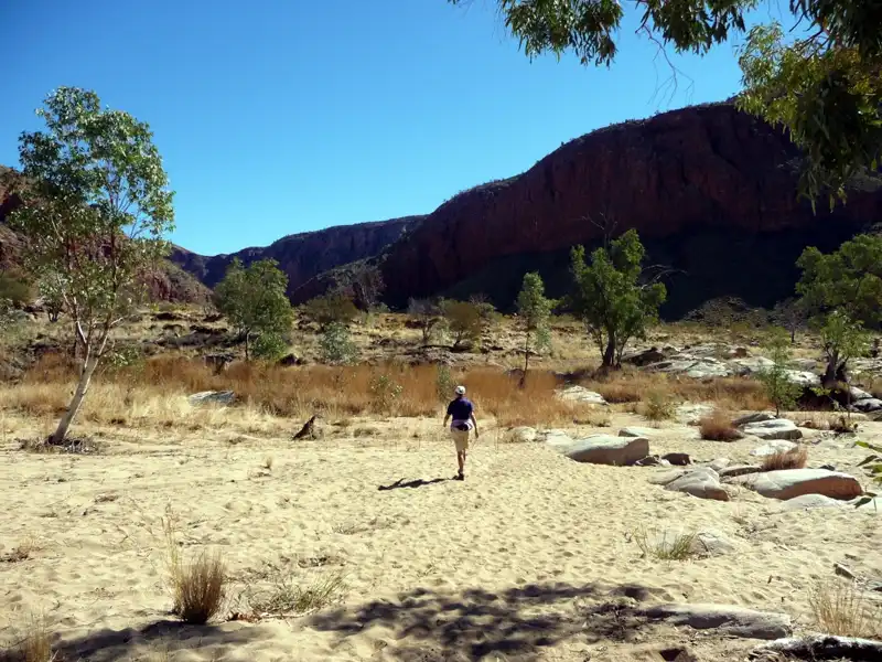
On our way to Glen Helen, we stopped at Ellery Creek Big Hole, a popular destination for swimming, picnicking, and camping in the West MacDonnell Ranges. Instead of taking a dip, we chose to hike the 2.5-kilometre Dolomite Circuit, exploring the stunning landscape along the way.
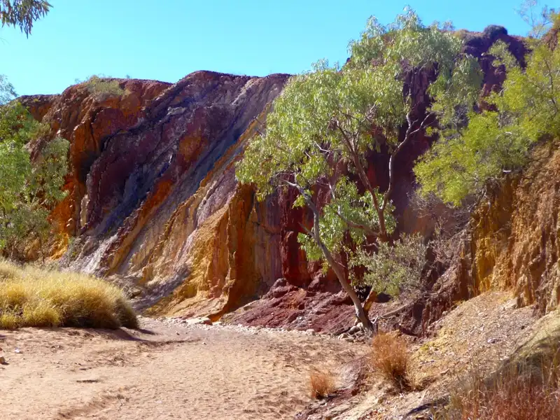
A short distance away lie the Ochre Pits, a striking exposed cliff where bands of ochre appear in vivid shades of red, yellow, white, and purple. For thousands of years, Aboriginal people have collected ochre from this site, using it for rock art, body painting, ceremonial practices, and traditional medicine.
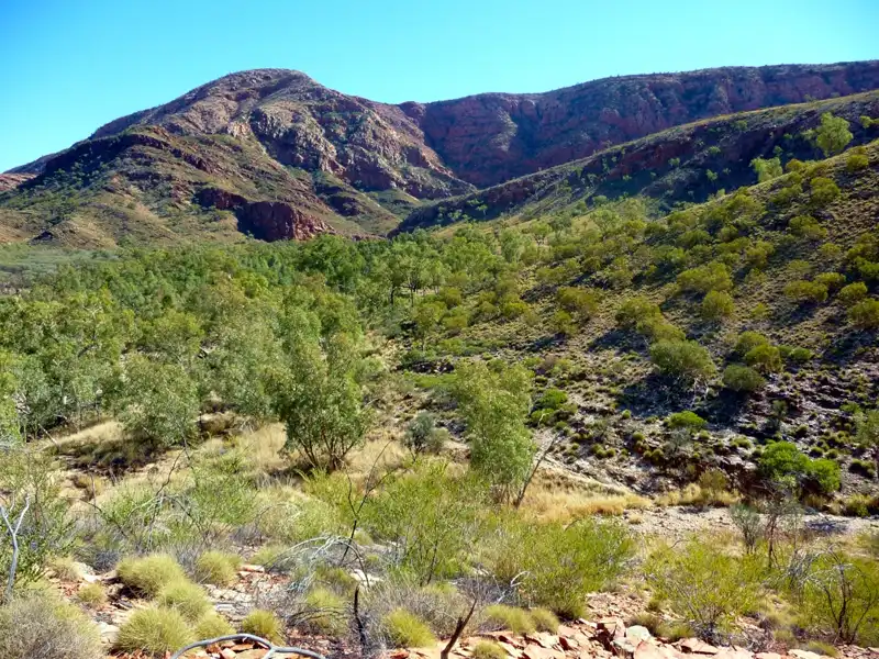
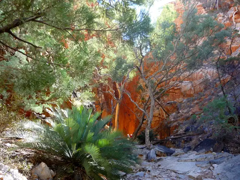
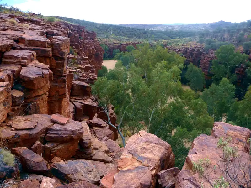
Next, we made our way to Ormiston Gorge and took on the Ormiston Pound Trail, a spectacular 9-kilometre loop widely regarded as one of the greatest hikes in the West MacDonnell Ranges. Over four hours, we climbed rocky hills, walked through open valleys, and gorges.
After climbing up the ridge, we were rewarded with a breathtaking panoramic view across the Ormiston Pound, before descending into the vast valley below, surrounded by rugged ridgelines and open desert scenery.
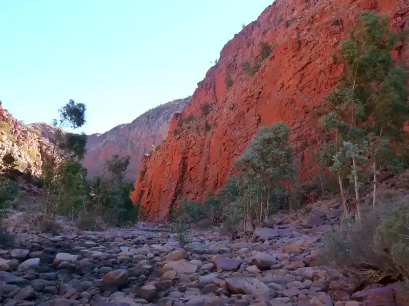
The walk finished with a stunning view of the glowing red cliffs, a perfect finale to an unforgettable hike. Standing there, it was impossible not to feel small against the ancient, rugged heart of the Red Centre.
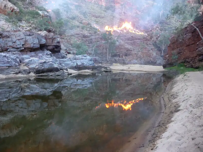
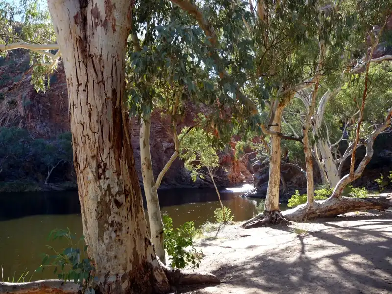
The permanent waterhole at Ormiston Gorge is a popular swimming spot, but after a full day on the trail, we’d had quite enough exercise. Instead, we rested and watched rangers carrying out backburning, the smoke and shifting light creating mesmerising reflections across the water. It was truly an incredible day.
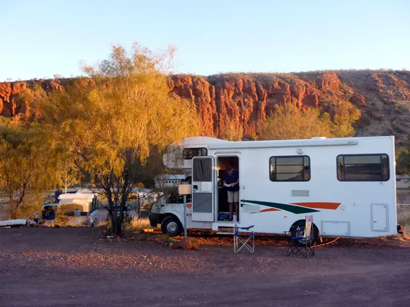
During our stay at the Glen Helen Resort campground, we thoroughly enjoyed the stunning scenery, scenic hikes, and refreshing swims in the waterhole. After long days on the trails, we relaxed with drinks and a meal at the restaurant. The best part? The piano man, who appeared each evening to provide the perfect soundtrack to our stay.
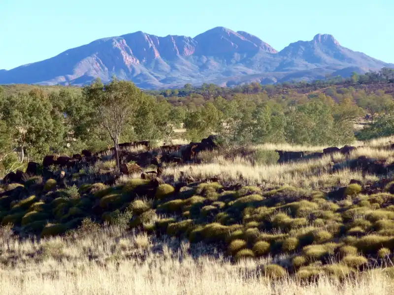
Mount Sonder, at 1380 metres above sea level, is the fourth-highest peak in the Northern Territory. The trail to Mount Sonder is about 16 kilometres long each way and can take 6-8 hours to complete. This hard hike wasn’t suitable for us.
Back to table of contents
East MacDonnell Ranges
The East MacDonnell Ranges extend 150 km east of Alice Springs, renowned for their stunning outback landscapes, including rugged gaps, dramatic gorges, scenic bushwalks, and ancient Aboriginal rock art. The first 75 km, up to Trephina Gorge, is sealed, while beyond that, a four-wheel-drive vehicle is recommended.
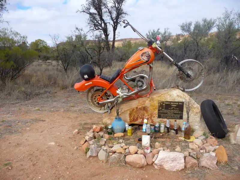
While the Ross Highway carries very little traffic, accidents still happen. A striking reminder of this is the roadside memorial for Terry Michael ‘Fish’ Gill, which is surrounded by countless beer bottles left in his honour. The VB can on the left? That one was from me.
We spent two wonderful days at Trephina Gorge Nature Park, 75 km from Alice Springs. The campground was excellent, with a well-maintained network of walking tracks. We wandered along the sandy creek bed, lined by majestic gum trees, and hiked up the ridges, where we had breathtaking views. In addition, there where abundant wildlife, it was an unforgettable experience.
While walking along the sandy creek bed, we loved the massive River Red Gums, Celery Trees, and the largest Ghost Gum in Australia. Standing an impressive 33 metres tall and estimated to be 300 years old, this magnificent tree is a true natural monument. Ghost Gums hold deep spiritual and cultural significance for Aboriginal people, adding a powerful sense of history and connection to the landscape.
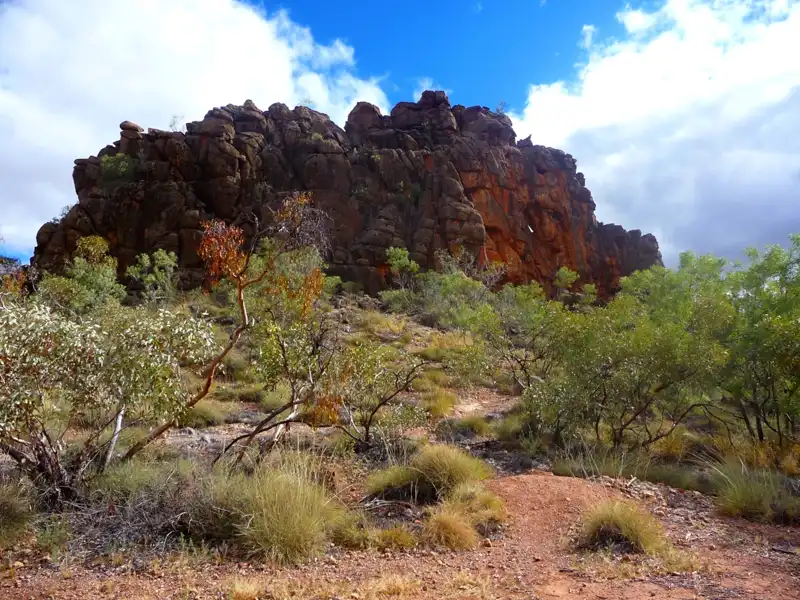
On the way back to Alice Springs, we stopped at the Corroboree Rock Conservation Reserve. We took a short walk around the base of the rock to explore majestic dolomite rock.
Back to table of contents
Palm Valley
Palm Valley, in the Finke Gorge National Park, is a spectacular area about 140 kilometres from Alice Springs. Accessible only by 4WD due to its rugged and sandy tracks. The valley is home to the ancient Finke River, believed to be one of the world’s oldest rivers, dating back 350 million years. This area is renowned for its Red Cabbage Palms remains of a time when Central Australia was covered in lush tropical forests millions of years ago.
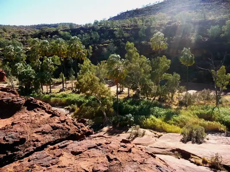
We went on a 4WD Outback Safari with AATKings, which was an excellent organised tour. We travelled through the West MacDonnell Ranges and along the way, we stopped at Hermannsburg, an Aboriginal Historic Precinct rich in history and culture. From there, we went further down the sandy bed of the ancient Finke River into the wonderful Palm Valley.
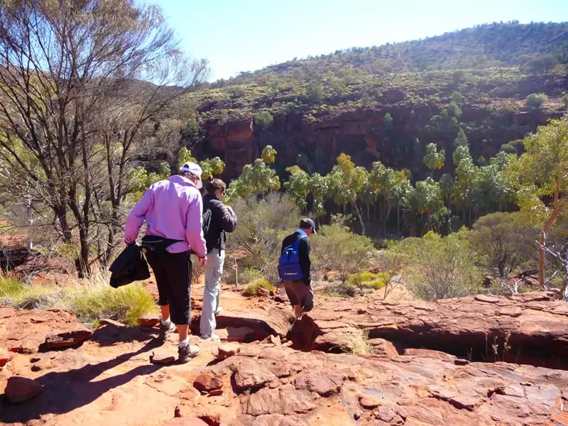
Our guide led us on a scenic 5 km trek—a rugged but rewarding two-hour return journey. With only a small group, the walk felt intimate as we navigated dramatic rock formations, soft white sands, and serene rock pools tucked away in groves of ancient palms. We capped off the adventure by gathering for a wonderful lunch, the perfect finale to our morning.
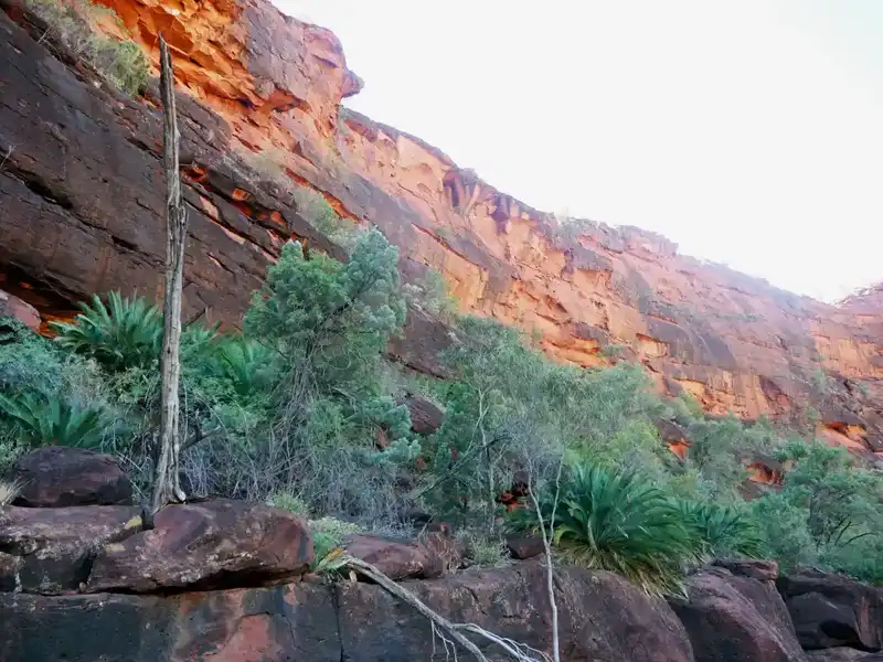
Before driving back to Alice Springs, we took time to enjoy the view of the towering red cliffs above Palm Valley. It was the perfect finale to an unforgettable journey through the Red Centre—one of the best hiking trips we have ever done in Australia. We can only hope that one day we’ll return to experience it all again.
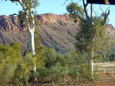
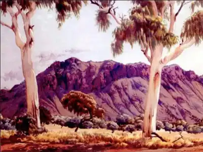
Photo 2009
Albert Namatjira famous watercolour painting ‘Twin Ghosts’
The heritage-listed ghost gums to the left of the image were once a beloved gathering place and a source of inspiration for the renowned Aboriginal artist Albert Namatjira. Tragically, the trees were destroyed in an arson attack in 2013, marking the loss of an important cultural and artistic landmark
Back to table of contents
More from Northern Territory: Kakadu & Litchfield National Park