Hiking in Tasmania: Mount Field & Cradle Mountain Highlights
Hiking in Tasmania has always drawn us back, especially when the summer heat on Australia’s east coast became too much. Time and again, we escaped to our beloved island state. The difference in temperature was striking—even in summer, we experienced snow on Kunanyi/Mount Wellington.
Tasmania offers some of the best hiking in Tasmania, from rainforest waterfalls in Mount Field to the dramatic alpine landscapes of Cradle Mountain
For hikers, they truly are a paradise. One of the great joys of the Apple Isle is its compact size — you can drive from one end of the island to the other in just three to four hours, yet experience an incredible variety of landscapes along the way.
Table of Contents
- Mount Field National Park
- Hikes from Lake Dobson
- Lake St Clair: Gateway to the South-West Wilderness
- Detour to Lake Pedder
- Nelson Falls and Montezuma Falls: Iconic Waterfalls of Tasmania
- Cradle Mountain
Mount Field National Park
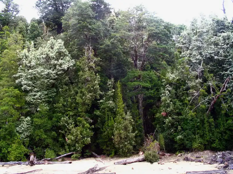
We loved visiting Mount Field National Park — it’s a fantastic destination for hiking and camping. Just a two-hour drive from Hobart, the park forms part of the Tasmanian Wilderness World Heritage Area.
We enjoyed exploring and photographing some of the world’s tallest eucalypt forests and its many cascading waterfalls. With hikes ranging from easy walks to more challenging treks, we managed to do most of them over our visits. The park also has a well-equipped visitor centre with a café, picnic areas, a children’s playground, and a campground. For non-campers, there are several accommodation options close by.
Discover Mount Field’s Magnificent Waterfalls

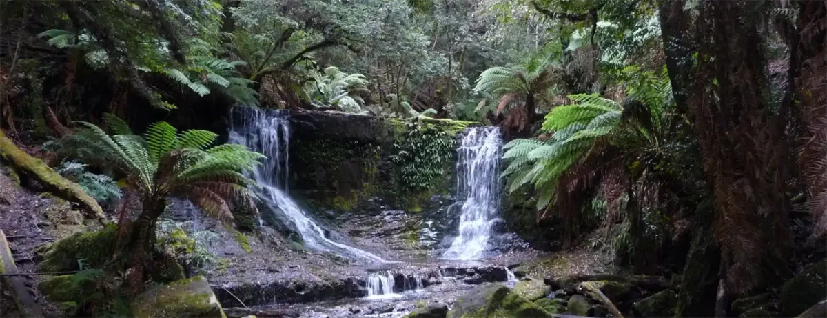
Our journey always began at Russell Falls, Tasmania’s most beloved waterfall. Surrounded by lush, moss-covered forest, we were always in awe as the water cascaded over multiple tiers. The walk to the falls is an easy 25-minute stroll through the forest from the visitor centre. On two occasions, we were lucky enough to spot a platypus in the nearby creek. After dark, the magic continued as glow worms lit up the vegetation near the falls, creating a truly enchanting experience.
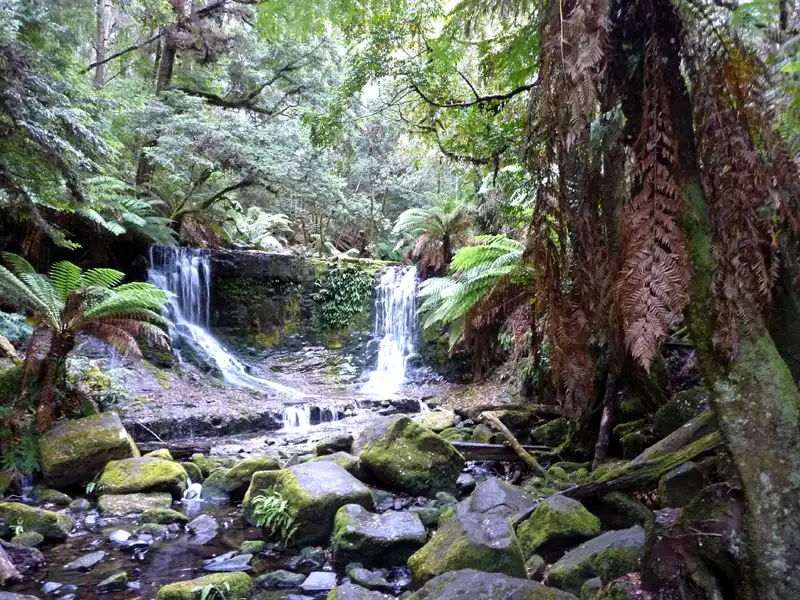
Horseshoe Falls is a short but steep 15-minute climb from Russell Falls. Though it is smaller, it is often considered even more beautiful. From there, you can either return to the Mount Field Information Centre or continue on the scenic 6 km circuit (approximately 2.5 hours).
The trail takes you through the majestic Tall Trees Walk, home to towering swamp gums, before leading to Lady Barron Falls—a charming, cascading waterfall nestled in lush rainforest.
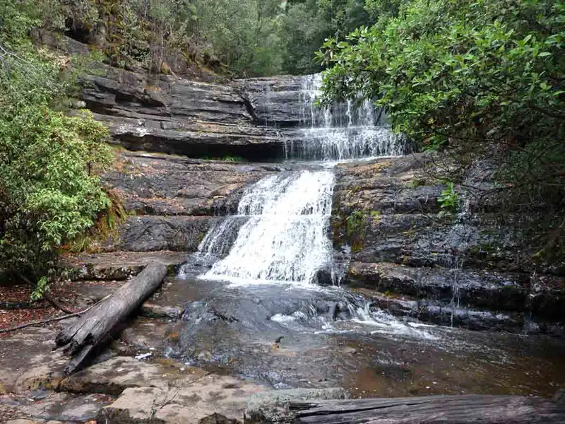
Lady Barron Falls is the third waterfall on the circuit, cascading around 8 metres.
To return to the information centre, you’ll need to climb a long staircase with hundreds of steps. If steep staircases are a concern, consider starting the circuit clockwise from the information centre so you can walk down the steps at the beginning of the trail.
Tasmania’s Tall Trees

The Tall Trees Walk is a must when visiting Mount Field. Hiking among these towering swamp gums — the tallest flowering plants on Earth — is a truly awe-inspiring experience.
These ancient trees can live for hundreds of years and reach heights of over 100 metres, provided they aren’t chopped down for wood chips.
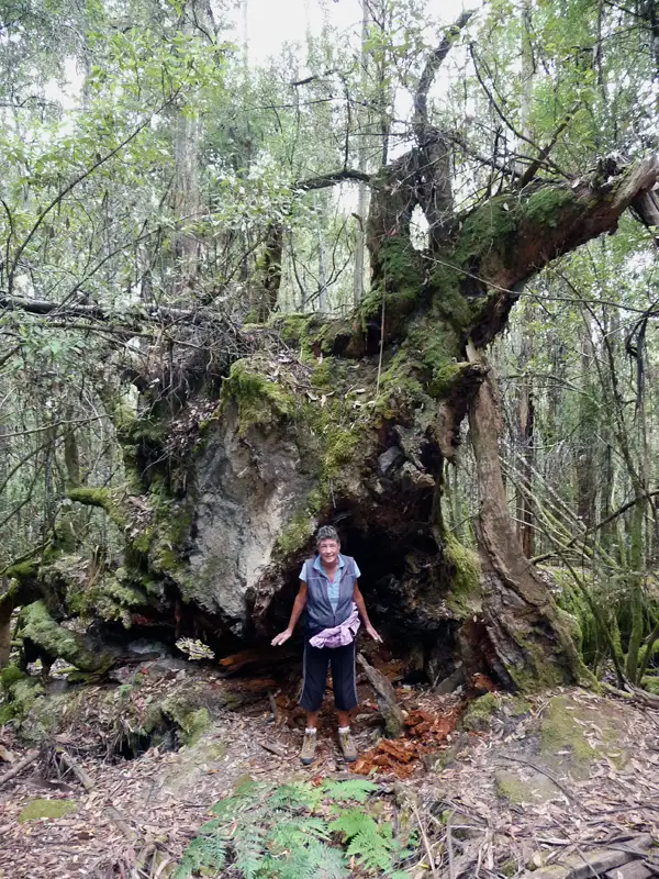
This photo shows the massive, moss-covered exposed root ball of a large fallen eucalypt on the Tall Trees Walk in Mount Field National Park, Tasmania, giving a sense of its incredible scale.
Back to table of contents
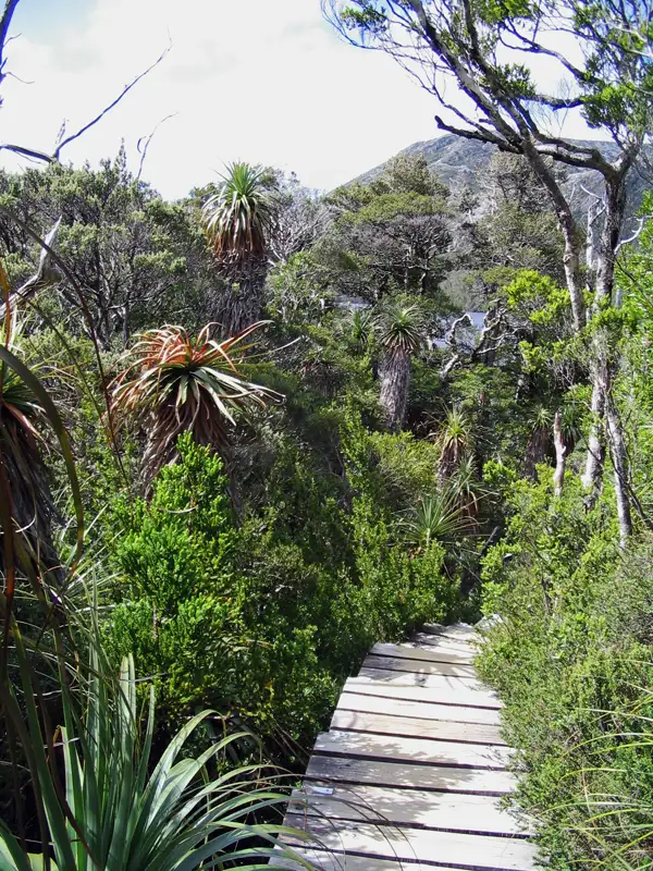
Hikes in Tasmania from Lake Dobson
Pandani Grove
Pandani Grove is a fantastic hike, and it’s one we’ve done on every visit to Mount Field. While it’s a bit challenging to reach, the journey is well worth it.
Access requires a drive (or a long walk) along a rugged 15 km dirt road that climbs nearly 1,000 metres to Lake Dobson. We always drove.
Once there, we enjoyed the easy 1.5 km circuit around the lake—a peaceful walk through a stunning subalpine landscape.
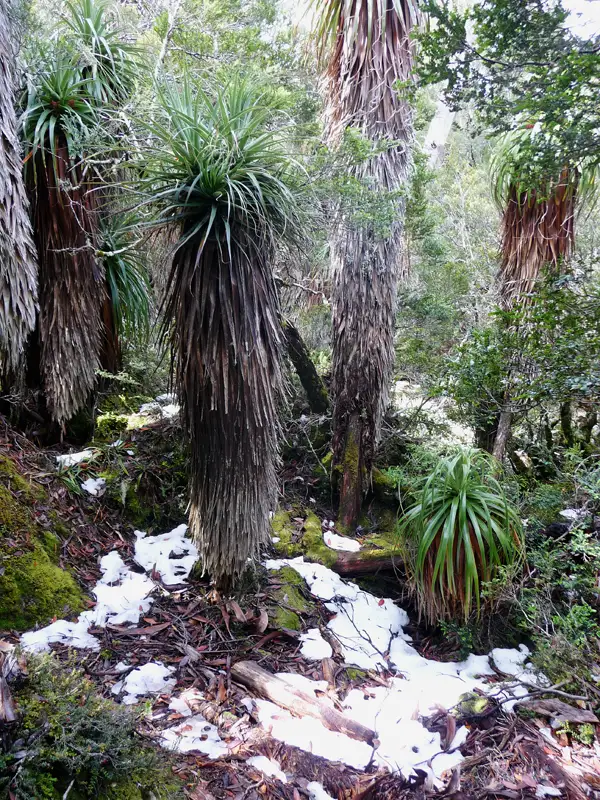
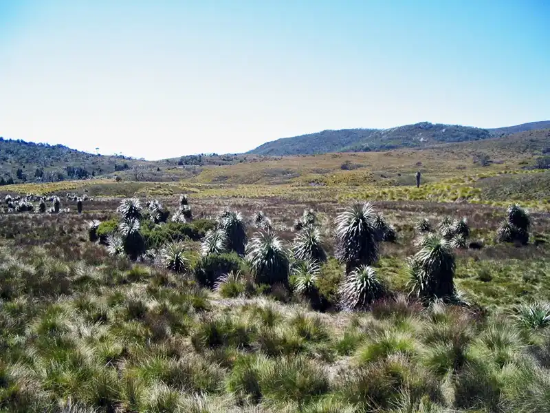
Pandani (Richea pandanifolia) can grow up to 12 meters tall and is the world’s tallest heath plant. It is found nowhere else on Earth but in the high-altitude wet forests and alpine regions of Tasmania, thriving in conditions where snow can still be found in the height of summer. Such conditions can be found around Lake Dobson.
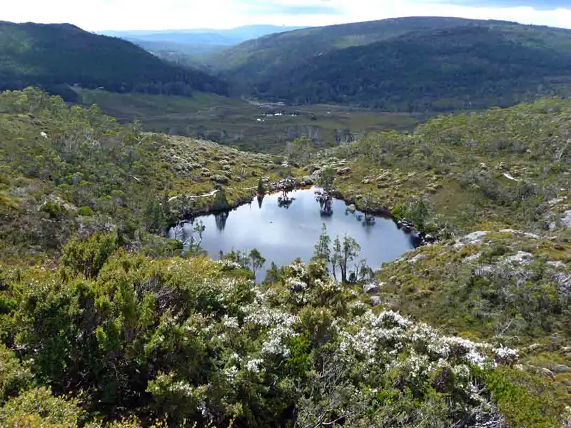
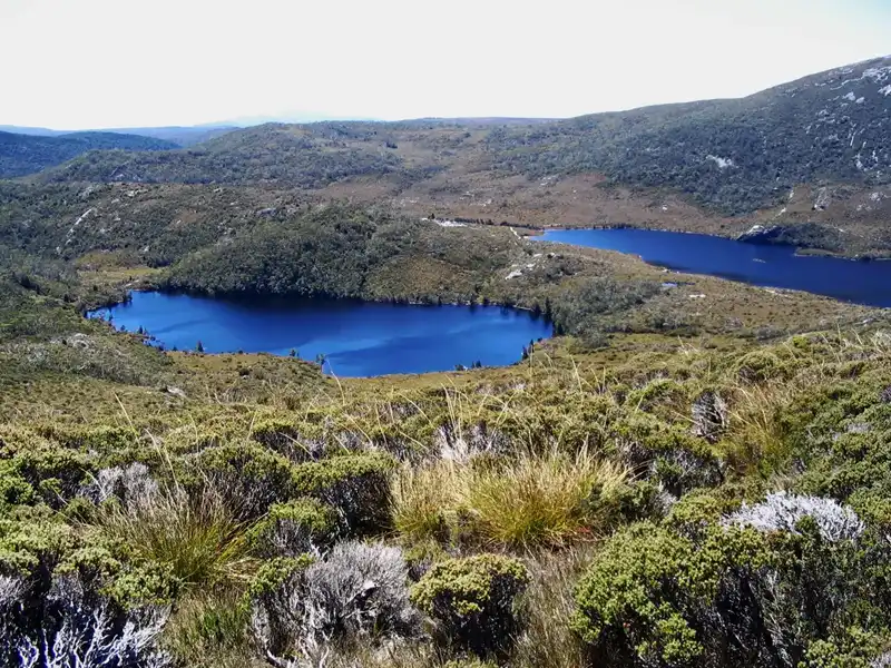
Tarn Shelf Circuit – Alpine Day Walk
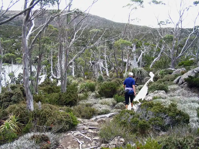
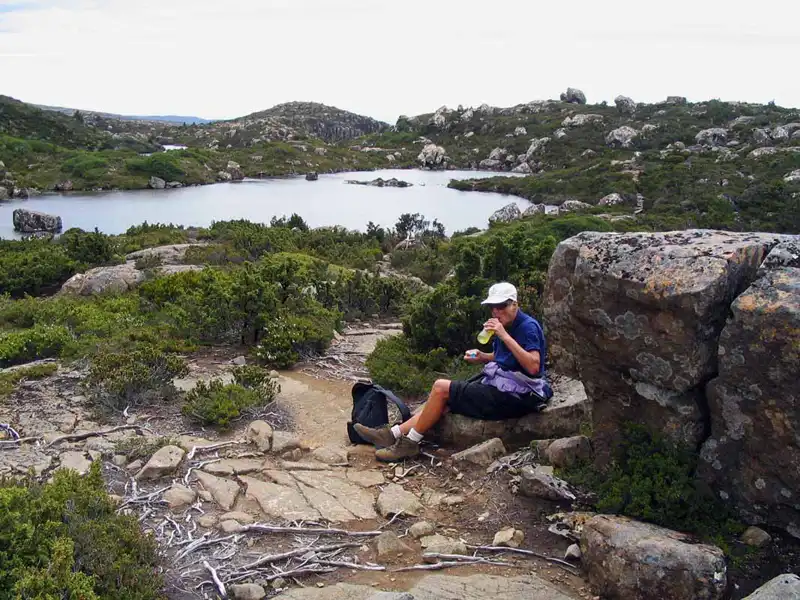
The Tarn Shelf Circuit was our favorite hike in Mount Field National Park—and one we completed three times. Starting at Lake Dobson, the trail climbs past the ski fields before reaching the stunning Tarn Shelf.
Along the way, it passes Lake Newdegate, Twilight Tarn, and Lake Webster before looping back to Lake Dobson. The circuit is 12 km long and took us about seven hours to complete.
The Tarn Shelf Circuit was a long and sometimes demanding walk, but the effort was rewarded many times over. Along the way, we found countless beautiful spots beside the many tarns—perfect places to stop, rest, and simply take in the peaceful alpine atmosphere.
The tarns on the Tarn Shelf were formed during the last ice age, when small glaciers carved shallow basins into the dolerite plateau. After the ice melted, these depressions filled with rain and snowmelt, creating the clear, often still alpine lakes that reflect the changing sky and surrounding mountains.
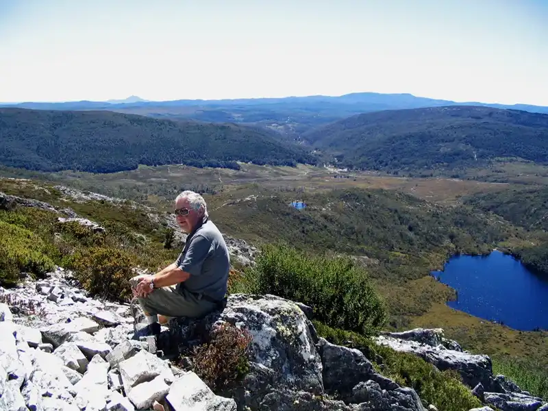
Mount Field West Summit (1,434 m)
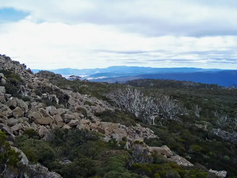
The hike from Lake Dobson to Mount Field West (1,434 metres above sea level) was extremely challenging. This Grade 5 track stretches over 17 kilometres and is very rough and steep throughout. Large sections required scrambling over rocky terrain. It was very exhausting.
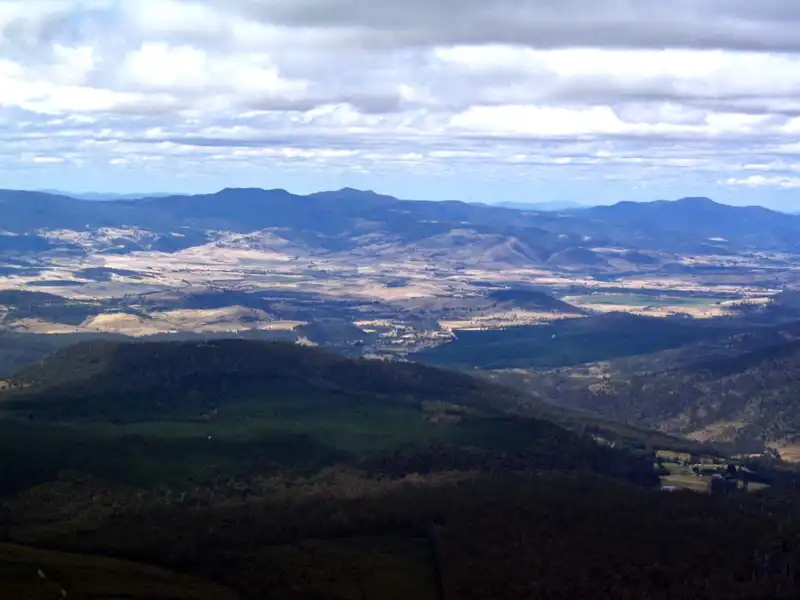
From the summit, we were rewarded with a fantastic panoramic view across the surrounding mountains. However, despite the impressive outlook, we found the hike itself less interesting than our favourite Tarn Shelf walk, and it wasn’t one we felt the need to repeat.
Back to table of contents
Detour to Lake Pedder (Southwest Wilderness Extension)
Original Lake Pedder was once a much smaller and extraordinarily beautiful lake, renowned for its rare pink quartzite beach — a natural feature found nowhere else in Australia. In the early 1970s, the lake was flooded as part of a major hydroelectric scheme, a decision that sparked one of Tasmania’s most significant environmental controversies.
By 1972, the original lake had disappeared beneath the rising waters, submerging around 230 square kilometres of wilderness, including unique vegetation and wildlife habitats.
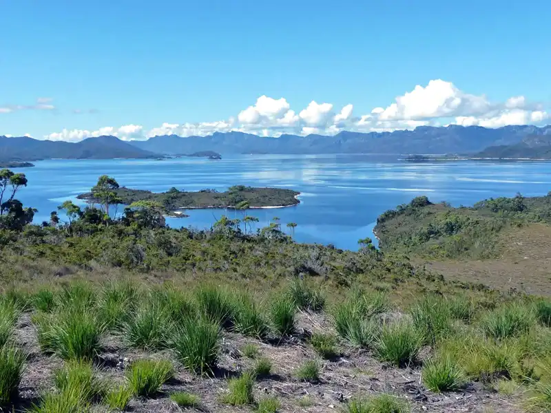
Today, the expanded Lake Pedder forms a vast inland water body surrounded by remote Southwest wilderness. While its history remains deeply emotional for many Tasmanians, the area is now known for kayaking, boating, fishing, and bushwalking in one of the most isolated landscapes in the state.
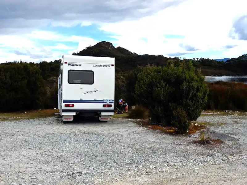
We stayed overnight in our motorhome at Teds Beach Campground on the shores of Lake Pedder. The campground, with electric barbecues, picnic tables and a camp kitchen, was almost empty — peaceful and wonderfully quiet. A breathtaking sunset over the vast lake made the evening even more special.
After several demanding hikes in Mount Field, we enjoyed a gentle stroll along the beach rather than another long walk. With more time, we would have tackled the Mount Sprent Summit Track — a steep 5-hour return hike with 760 metres of elevation gain and sweeping Southwest wilderness views.

I was lucky to have a 5 stars chef in our motorhome. Tonight’s dish includes smoked quail, asparagus, broccoli, and a creamy mushroom sauce.
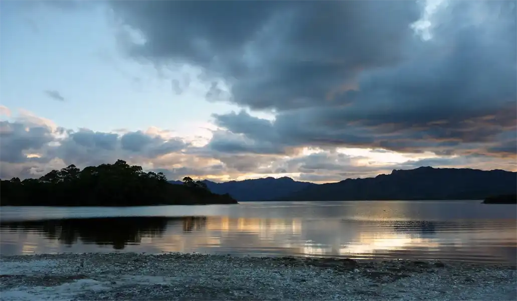
We were privileged to have Lake Pedder all to ourselves.
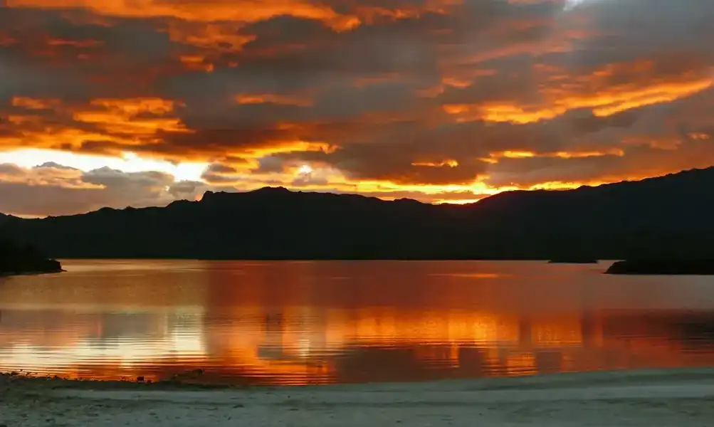
As the sun dipped below the horizon, the colour shifted from silver to rich gold in just 20 minutes.
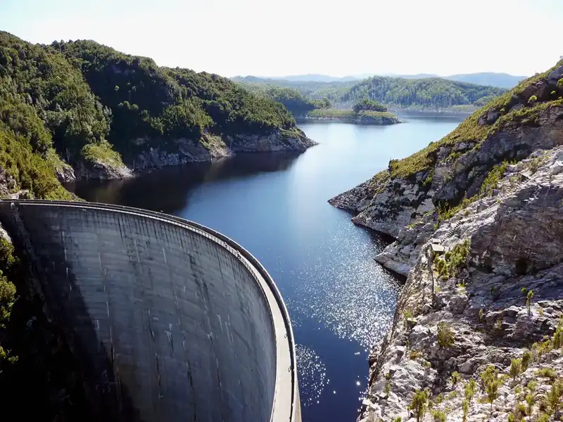
Gordon Power Station is Tasmania’s biggest power station. The Gordon River dam is 140 metres high, and water from Lake Gordon flows into the river.
Back to table of contents
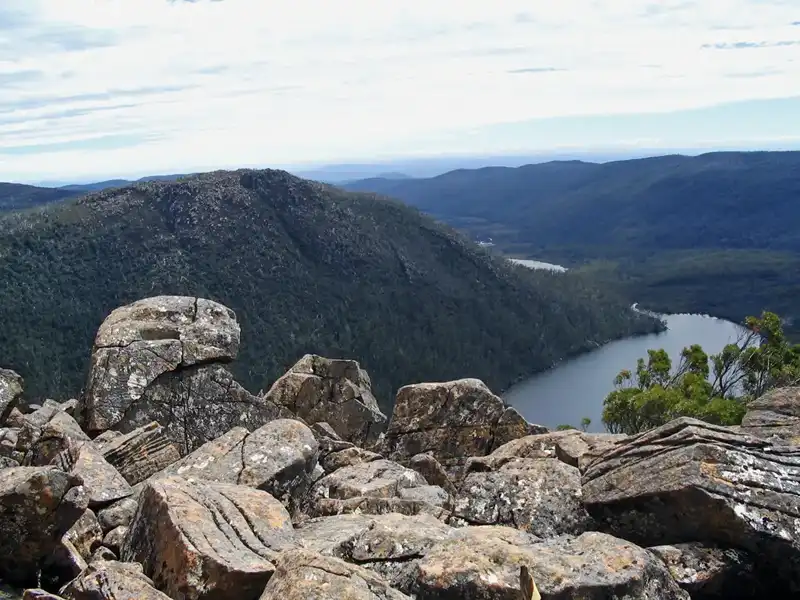
Lake St Clair – Gateway to the Wilderness
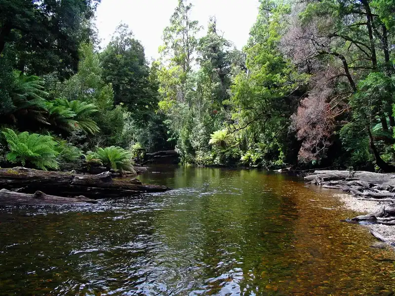
Whenever we drove through Tasmania, we would spend several days at Lake St Clair. The lake is calm and The Aboriginals called it Leeawuleena, meaning “sleeping water.” It’s Australia’s deepest freshwater lake and is in the Cradle Mountain-Lake St Clair National Park.It marks the endpoint of the iconic Overland Track, a multi-day hike through Tasmania’s wilderness. Though we’re no longer as young as we once were, we are proud to have completed the first part of the track and to have hiked its final section many times.
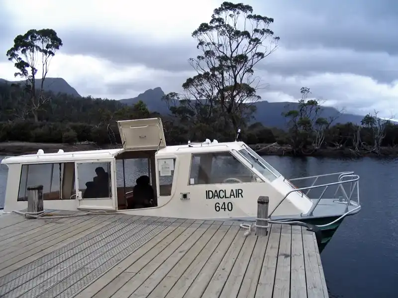
We took the 20-minute ferry from Cynthia Bay to Echo Point Walker’s Hut and from there hiked the final section of the famous Overland Track. The 11-kilometre walk back to Cynthia Bay took us about five hours. While not technically difficult, the track includes several steep sections and a rough, uneven surface. Much of the walk follows the lakeshore and winds through dense rainforest, making it both scenic and peaceful. It’s easy to understand why some Overland Track walkers choose the ferry for the return journey, tempted by the promise of a hot shower, a comfortable bed, and a well-earned good meal.
We enjoyed staying in St. Claire,peaceful with abundant wildlife. We watched wallabies, pademelons and wombats. Once we spotted even the elusive platypus. We loved the smell of the large gum trees and the blooming Leatherwood trees. We stayed there in our motorhome and sometimes in nice cabins. There is also a great restaurant for feeding the hungry bushwalker.
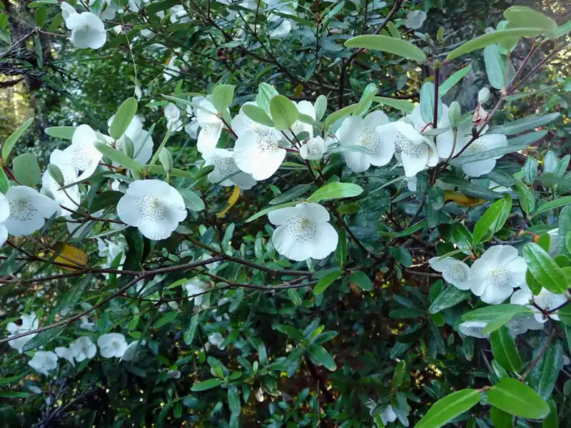
The Leatherwood flowers are beautiful, and the bees do an amazing job turning their nectar into the distinctive, delicious Leatherwood honey. We always buy Leatherwood honey from Stephens at Mole Creek before heading home—it’s a tradition we never miss.
Back to table of contents
Nelson Falls & Montezuma Falls
Nelson Falls: A Must-Stop in the Franklin-Gordon Wild Rivers NP
On our drive from Derwent Bridge to Queenstown, we stopped for a short walk to Nelson Falls in the Franklin-Gordon Wild Rivers National Park. The trail offered a glimpse of the surrounding wilderness, where beautiful sassafras, myrtle trees, and ferns lined the path. We love squeezing the sassafras leaves because they release a spicy scent.

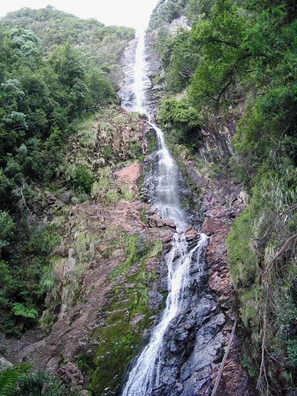
Despite the lower flow, which meant less water cascading down the 30-meter drop into the Nelson River, Nelson Falls still managed to feel vast and incredibly impressive.
Montezuma Falls – Tasmania’s Tallest Waterfall
The Montezuma Falls near the town of Rosebery on Tasmania’s West Coast, is truly amazing in many ways. Firstly, it was named after Montezuma (1466 1520), the Aztec emperor of Mexico, because the Silver Mining Company that held the lease was called Montezuma. Secondly, the track follows the path of a former tramway, adding a historical touch to the hike. Lastly, with a 104-meter drop, Montezuma Falls is the tallest waterfall in Tasmania, and the track takes you right to the base, gives a stunning view of the falls. The hike is an easy, graded 2.12 km loop, it took us about 3 hours walking through lush rainforest.

The suspension bridge at Montezuma Falls is a highlight of the walk. Hanging high above the forest floor, it offers dramatic views of the surrounding rainforest and a first glimpse of the impressive waterfall cascading down the cliff face.
The view of Montezuma Falls plunging 104 metres down the cliff face is truly stunning, making it the tallest waterfall in Tasmania.
Back to table of contents
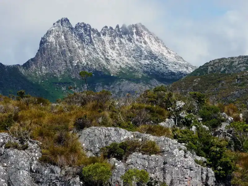
Cradle Mountain National Park – One of the Best Hiking Experiences in Tasmania
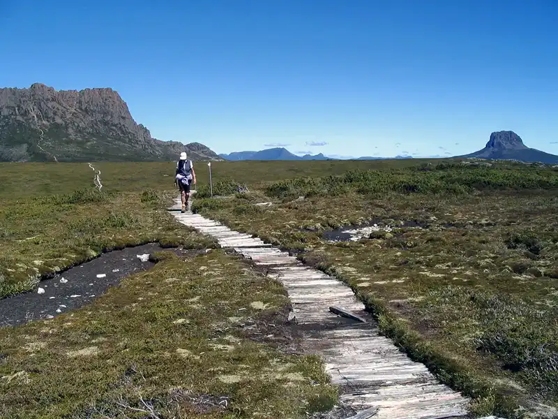
From gentle walks like the Dove Lake Circuit and Cradle Valley Boardwalk to challenging hikes up Marion’s Lookout and Crater Peak, the park offers something for every hiker.
Spot wombats, pademelons, and yellow-tailed black cockatoos while wandering through button grass plains, cool-temperate rainforests, and mossy alpine landscapes. Don’t miss the Ballroom Forest, ancient pencil pines, and the world’s tallest heath, pandani.
Stunning alpine lakes—Dove Lake, Lake Lilla, and Crater Lake—offer unforgettable views at every turn. Whether hiking, photographing, or simply soaking in Tasmania’s natural beauty, Cradle Mountain is a must-visit destination.
Excellent visitor facilities include a modern visitor centre, a convenient shuttle bus system, scenic helicopter flights, and a wide range of accommodation options, from campgrounds and wilderness villages to cosy cabins. After a long hike, cafés and taverns provide the perfect place to relax, and the nearby wildlife centre offers the chance to see Tasmanian devils up close.
The Cradle Valley Boardwalk
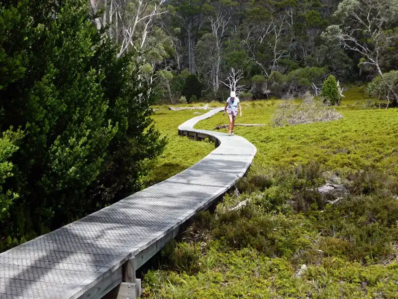
A great way to start exploring Cradle Mountain is the Cradle Valley Boardwalk, a 5.5-kilometre one-way walk that begins at the Ranger Station and winds through the heart of Tasmania’s alpine wilderness to Ronny Creek Car Park and bus stop. We’ve walked it many times, and one of its biggest advantages is flexibility—you can easily tackle it in sections by hopping on and off the park’s excellent shuttle bus system.
As you wander through button grass moorlands, keep a close eye out for wombats, especially at dusk. You may also spot shy pademelons and the striking yellow-tailed black cockatoos.
The vegetation is just as fascinating, with ancient pencil pines and Tasmania’s beech (Nothofagus gunnii), which turns gold in autumn.
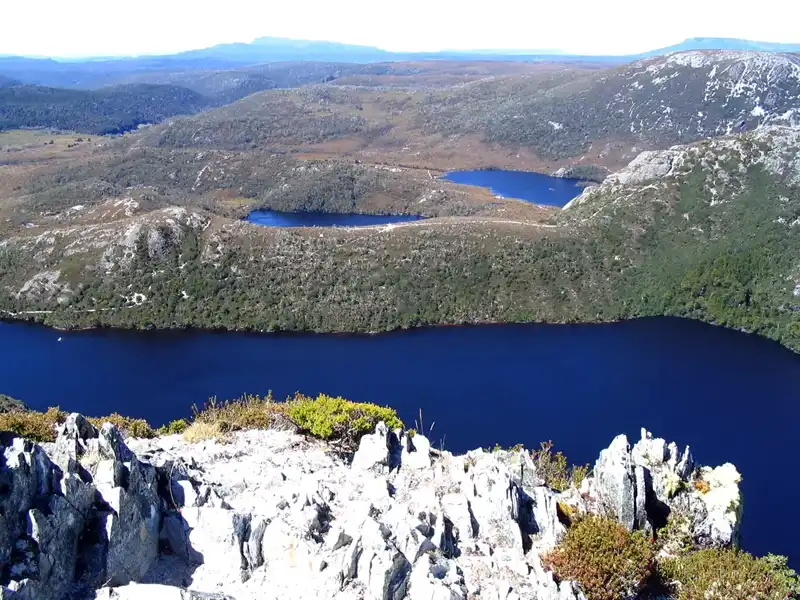
Dove Lake Circuit
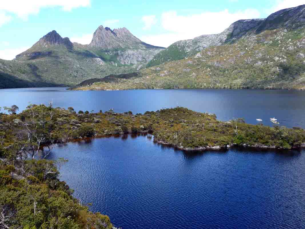
Whenever we visit Cradle Mountain, the Dove Lake Circuit is a must-do walk for us. It’s an ideal hike for those who may not be extremely fit but still want to experience the area’s spectacular scenery. This Grade 3 circuit takes around 2 to 3 hours to complete and includes a mix of gentle climbs, some steeper sections, boardwalks, and gravel paths. Along the way, several breathtaking viewpoints offer stunning views across Dove Lake to the surrounding mountains. It’s easy to see why this is the most popular walk at Cradle Mountain.
We loved walking through the cool-temperate rainforest of the Ballroom Forest, surrounded by myrtle, King Billy pines, and sassafras. The experience truly felt like stepping into a majestic cathedral. Along the circuit, we also spotted pandani (Richea pandanifolia), the world’s tallest heath, which can reach heights of up to 10 metres.
Another delightful walk we enjoyed began with a shuttle bus drop-off at Ronny Creek. The track crosses open button grass plains—an area well known for wombat sightings—before reaching the peaceful Lake Lilla.
Continuing on, we eventually arrived at Dove Lake, completing a scenic circuit that offers a wonderful mix of landscapes, from open moorland to alpine lake scenery.
Marion’s Lookout
We tackled the rewarding hike from Ronny Creek to Marion’s Lookout (reaching 1,223 metres), a walk that can be challenging in certain places. This is especially true for the final steep sections, which involve stairs and a rocky scramble where chains are provided for aid. This particular section of the track may not be suitable for young children or older hikers—except for us, of course!
The effort is well rewarded, though: from the lookout, we enjoyed stunning views over Lake Lilla, Wombat Pools, and Ronny Creek.
Hiking in Tasmania is not just a recreational activity; it’s an experience that immerses you in the stunning landscapes and rich biodiversity of the region.
For those seeking adventure, Tasmania is known for its iconic hikes and breathtaking scenery.
From Marion’s Lookout, we followed the Overland Track to Kitchen Hut where we had a break. Along the way, we had a fantastic view of the iconic Bluff Barn. A picturesque spot that’s often photographed from every angle. Then we descended via the Horse Track.
We did this hike in our seventies—the stepped sections were challenging, but absolutely worth it. From Crater Peak, the views are spectacular, stretching across Crater Lake, Lake Lilla, and Dove Lake. We hope our experience convinces others that the Marion’s Lookout hike is truly worth the effort.
Back to table of contents
More from Tasmania: East and West Coast
More from Tasmania: Hobart and South